
IMAGES TAKEN NEAR TO
Tebay Close, MIDDLESBROUGH, TS7 9JT
Introduction
This page details the photographs taken nearby to Tebay Close, TS7 9JT by members of the Geograph project.
The Geograph project started in 2005 with the aim of publishing, organising and preserving representative images for every square kilometre of Great Britain, Ireland and the Isle of Man.

There are currently over 7.5m images from over14,400 individuals and you can help contribute to the project by visiting https://www.geograph.org.uk
Image Map
Images are licensed for reuse under creativecommons.org/licenses/by-sa/2.0
Notes
- Clicking on the map will re-center to the selected point.
- The higher the marker number, the further away the image location is from the centre of the postcode.
Image Listing (10 Images Found)
Images are licensed for reuse under creativecommons.org/licenses/by-sa/2.0
Image
Details
Distance
1
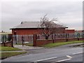
Reservoir building in Ormesby
This photograph shows a view of one of the buildings associated with the underground reservoir located near the roundabout at the junction of the A171 and B1380 roads in Ormesby. The picture was taken from the opposite side of the road looking in a northerly direction towards Thorntree.
Image: © Philip Barker
Taken: 4 Feb 2010
0.07 miles
2
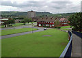
View from the bridge
The closer road is Thursby Drive, leading onto Allendale Road. Wetherby Green runs to the right of the houses.
On the left of the picture is St Gabriel's RC Primary School. The tower block is Spencerbeck House.
Update: This view is no more. The bridge was demolished in May 2008.
Image: © Stephen McCulloch
Taken: 26 Jun 2007
0.09 miles
3
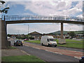
Footbridge over Normanby Road
Bridge linking Netherfields and Overfields estates.
Under the bridge can be seen St Gabriel's church and school to its right, with Eston Hills in the distance.
Update: The footbridge was demolished in May 2008.
Image: © Stephen McCulloch
Taken: 26 Jun 2007
0.10 miles
4
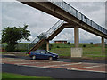
That Bridge Again
Footbridge over Normanby Road.
Looking towards the covered reservoir near Ormesby Roundabout.
Update: The bridge was demolished in May 2008.
Image: © Stephen McCulloch
Taken: 3 Jul 2007
0.11 miles
5
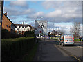
Ormesby Roundabout
Approaching from the south.
The spire on the new flats, to the left of the sign, was saved from the church hall (I think) that used to be on the site.
Image: © Stephen McCulloch
Taken: 5 Feb 2008
0.11 miles
6
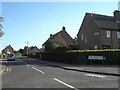
Henry Taylor Court Bungalows.
Henry Taylor Court Bungalows, Ormesby.
Image: © Darren Haddock
Taken: 12 Sep 2006
0.15 miles
7
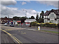
Ormesby High Street
Looking west from near to Ormesby Roundabout.
The building in the distance is the Fountain pub.
In middle distance was previously a Safeway supermarket (Hintons for those of us with longer memories), now converted to a variety of smaller shops.
The white building was an old people's home, now empty I think.
Image: © Stephen McCulloch
Taken: 26 Jun 2007
0.15 miles
8
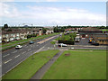
Normanby Road
Looking along Normanby Road, showing its junction with Allendale Road.
St Gabriel's Church is on the right.
On the skyline can be seen Corus' Lackenby steelworks (between the 2 lampposts) and cooling towers from the Wilton chemical site.
Image: © Stephen McCulloch
Taken: 26 Jun 2007
0.17 miles
9
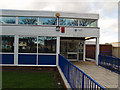
Ormesby Library
Library on Sunnyfield. Houses on Wellby Grove can be seen reflected in the windows (as can I).
Image: © Stephen McCulloch
Taken: 5 Feb 2008
0.20 miles
10
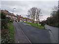
Jubilee Bank
One of two housing developments built for workers on the Ormesby Hall estate (the other is Coronation Green). The road on the right of the picture is Church Lane.
Image: © Stephen McCulloch
Taken: 5 Feb 2008
0.23 miles