
IMAGES TAKEN NEAR TO
Belasis Avenue, BILLINGHAM, TS23 1QY
Introduction
This page details the photographs taken nearby to Belasis Avenue, TS23 1QY by members of the Geograph project.
The Geograph project started in 2005 with the aim of publishing, organising and preserving representative images for every square kilometre of Great Britain, Ireland and the Isle of Man.

There are currently over 7.5m images from over14,400 individuals and you can help contribute to the project by visiting https://www.geograph.org.uk
Image Map
Images are licensed for reuse under creativecommons.org/licenses/by-sa/2.0
Notes
- Clicking on the map will re-center to the selected point.
- The higher the marker number, the further away the image location is from the centre of the postcode.
Image Listing (14 Images Found)
Images are licensed for reuse under creativecommons.org/licenses/by-sa/2.0
Image
Details
Distance
2
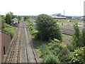
View East from Belasis Avenue Bridge
The Haverton Hill railway line with Belasis Lane signal box. Out of shot to the right is a huge chemical plant which I was not allowed to photograph.
Image: © Stephen Armstrong
Taken: 6 Jun 2011
0.05 miles
3
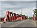
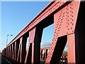
Belasis Avenue Bridge
This carries the road over the Haverton Hill railway line.
Image: © Stephen Armstrong
Taken: 6 Jun 2011
0.06 miles
4
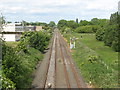
View West from Belasis Avenue Bridge
Still semaphore signalling around here.
Image: © Stephen Armstrong
Taken: 6 Jun 2011
0.07 miles
5
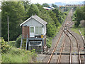
Belasis Lane Signal Box
On the Haverton Hill line. Viewed from Belasis Avenue bridge. Note the lean-to greenhouse & the semaphore signal in the distance.
Image: © Stephen Armstrong
Taken: 6 Jun 2011
0.07 miles
6
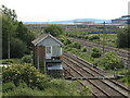
Belasis Lane Signal Box, Billingham
Image: © Stephen Armstrong
Taken: 6 Jun 2011
0.07 miles
7
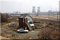
Belasis Lane signal box
This photograph shows a view of the railway signal box on the Haverton Hill railway line near Belasis Hall Technology Park. The picture was taken from the B1275 road looking in a south-south-easterly direction towards Bamlett's Wharf on the River Tees.
Image: © Philip Barker
Taken: 25 Mar 2010
0.10 miles
8
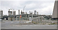
ICI Billingham, September 1970 No. 3
See Image] etc.
Image: © Ben Brooksbank
Taken: 6 Sep 1970
0.12 miles
9
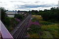
Belasis Lane Station (remains) - 30 years on
This is my take on Image "Belasis Lane Station (remains)" taken 30 years on from the original. There's considerably more vegetation, with Rosebay Willowherb obscuring the site of the station nameboard making it impossible to see if it still exists.
The most striking change has taken place in field to the right of the railway; a playing field in 1970 and rough pasture with a copse of trees in 2010.
Image: © Graham Scarborough
Taken: 11 Aug 2010
0.13 miles
10
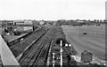
Belasis Lane Station (remains)
View westward, towards Billingham; Billingham - Haverton Hill - Port Clarence branch. The line was served by regular passenger trains until 14/6/54, but to workmen's service until 6/11/61 and to goods until 2/11/64. Note the nameboard remained in 1970. The Halt was only opened in May 1928.
Image: © Ben Brooksbank
Taken: 6 Sep 1970
0.14 miles