Belasis Lane Station (remains)
Introduction
The photograph on this page of Belasis Lane Station (remains) by Ben Brooksbank as part of the Geograph project.
The Geograph project started in 2005 with the aim of publishing, organising and preserving representative images for every square kilometre of Great Britain, Ireland and the Isle of Man.

There are currently over 7.5m images from over 14,400 individuals and you can help contribute to the project by visiting https://www.geograph.org.uk
Belasis Lane Station (remains)
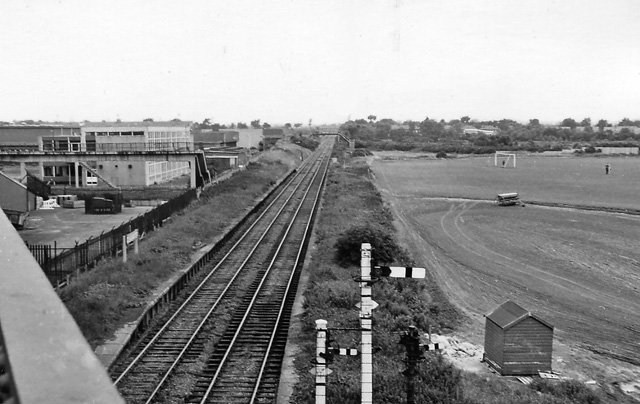
Image: © Ben Brooksbank Taken: 6 Sep 1970
View westward, towards Billingham; Billingham - Haverton Hill - Port Clarence branch. The line was served by regular passenger trains until 14/6/54, but to workmen's service until 6/11/61 and to goods until 2/11/64. Note the nameboard remained in 1970. The Halt was only opened in May 1928.
Images are licensed for reuse under creativecommons.org/licenses/by-sa/2.0
Image Location
Latitude
54.600087
Longitude
-1.273703