Belasis Lane Station (remains) - 30 years on
Introduction
The photograph on this page of Belasis Lane Station (remains) - 30 years on by Graham Scarborough as part of the Geograph project.
The Geograph project started in 2005 with the aim of publishing, organising and preserving representative images for every square kilometre of Great Britain, Ireland and the Isle of Man.

There are currently over 7.5m images from over 14,400 individuals and you can help contribute to the project by visiting https://www.geograph.org.uk
Belasis Lane Station (remains) - 30 years on
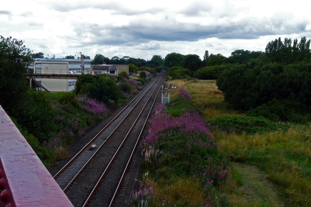
Image: © Graham Scarborough Taken: 11 Aug 2010
This is my take on Image "Belasis Lane Station (remains)" taken 30 years on from the original. There's considerably more vegetation, with Rosebay Willowherb obscuring the site of the station nameboard making it impossible to see if it still exists. The most striking change has taken place in field to the right of the railway; a playing field in 1970 and rough pasture with a copse of trees in 2010.
Images are licensed for reuse under creativecommons.org/licenses/by-sa/2.0
Image Location
Latitude
54.599995
Longitude
-1.273395