1
The Slapewath Gap
The defile between Belmont Bank and Airy Hill, the “natural” route east from Guisborough and on to Whitby. A route that would clearly connect up with the medieval trod, the Quakers Causeway, across the moors. In 1861 the Cleveland Railway was built through the gap to access the ironstone mines of East Cleveland enticing landowners along the route to seek a piece of the ironstone boom. Among them, Henry Thomas who owned the Hollin Hill Farm, left of centre in the photo. Subsequently, Slapewath Mine was opened and operated by Thomas Charlton and Company. To house his workers Charlton built the rows of terraced houses just right of centre, known to this day as Charltons. Initially, the mine was accessed by a drift going in under the main road but in 1878 a shaft was sunk to the south of Hollin Hill Farm and connected to the Cleveland Railway by a short branch line.
From my photo-diary for 23rd December 2019 see http://www.fhithich.uk/?p=22064
Image: © Mick Garratt
Taken: 23 Dec 2019
0.01 miles
2
At the bus stop, Slapewath
An awkwardly placed bus stop for following traffic, especially as in principle buses in this direction could go left at the turning. This a small loop returning shortly to the main A171 road.
Image: © Robin Webster
Taken: 8 Oct 2011
0.02 miles
3
Slapewath
From the motor cycle scrambling area at Spa Wood.
Image: © Mick Garratt
Taken: 22 Feb 2010
0.03 miles
4
The Fox and Hounds
Image: © John Slater
Taken: 12 Sep 2018
0.06 miles
5
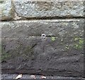
Slapewath bridge
The bolt benchmark is cut into the east parapet and is on the lowest course of stone.
Image: © Mel Towler
Taken: 16 Aug 2022
0.06 miles
6
Slapewath bridge
There is a bolt benchmark cut into the east parapet and the cutmark is on the lowest course of stone.
Image: © Mel Towler
Taken: 16 Aug 2022
0.06 miles
7
The Fox and Hounds at Slapewath.
Pub alongside The Cleveland way.
Image: © steven ruffles
Taken: 22 Mar 2015
0.07 miles
8
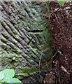
Slapewath, Cleveland Street Walk
There is a benchmark cut into the gatepost on the north side of the track. The track is part of the long distance footpath, The Cleveland Way.
Image: © Mel Towler
Taken: 16 Aug 2022
0.09 miles
9
Slapewath, Cleveland Street Walk
The benchmark is cut into a gatepost on the north side of the track. The track is part of the long distance footpath, The Cleveland Way.
Image: © Mel Towler
Taken: 16 Aug 2022
0.09 miles
10
Sliproad to the A171, Slapewath
The slip road takes you back to the A171 from the Fox and Hounds public house.
Image: © Maigheach-gheal
Taken: 18 Oct 2007
0.11 miles


