The Slapewath Gap
Introduction
The photograph on this page of The Slapewath Gap by Mick Garratt as part of the Geograph project.
The Geograph project started in 2005 with the aim of publishing, organising and preserving representative images for every square kilometre of Great Britain, Ireland and the Isle of Man.

There are currently over 7.5m images from over 14,400 individuals and you can help contribute to the project by visiting https://www.geograph.org.uk
The Slapewath Gap
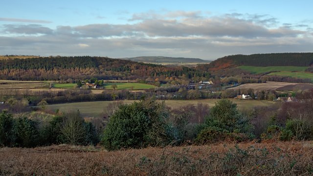
Image: © Mick Garratt Taken: 23 Dec 2019
The defile between Belmont Bank and Airy Hill, the “natural” route east from Guisborough and on to Whitby. A route that would clearly connect up with the medieval trod, the Quakers Causeway, across the moors. In 1861 the Cleveland Railway was built through the gap to access the ironstone mines of East Cleveland enticing landowners along the route to seek a piece of the ironstone boom. Among them, Henry Thomas who owned the Hollin Hill Farm, left of centre in the photo. Subsequently, Slapewath Mine was opened and operated by Thomas Charlton and Company. To house his workers Charlton built the rows of terraced houses just right of centre, known to this day as Charltons. Initially, the mine was accessed by a drift going in under the main road but in 1878 a shaft was sunk to the south of Hollin Hill Farm and connected to the Cleveland Railway by a short branch line. From my photo-diary for 23rd December 2019 see http://www.fhithich.uk/?p=22064
Images are licensed for reuse under creativecommons.org/licenses/by-sa/2.0
Image Location
Latitude
54.533869
Longitude
-1.009994