
IMAGES TAKEN NEAR TO
Chapel Hill, PERRANPORTH, TR6 0DQ
Introduction
This page details the photographs taken nearby to Chapel Hill, TR6 0DQ by members of the Geograph project.
The Geograph project started in 2005 with the aim of publishing, organising and preserving representative images for every square kilometre of Great Britain, Ireland and the Isle of Man.

There are currently over 7.5m images from over14,400 individuals and you can help contribute to the project by visiting https://www.geograph.org.uk
Image Map
Images are licensed for reuse under creativecommons.org/licenses/by-sa/2.0
Notes
- Clicking on the map will re-center to the selected point.
- The higher the marker number, the further away the image location is from the centre of the postcode.
Image Listing (11 Images Found)
Images are licensed for reuse under creativecommons.org/licenses/by-sa/2.0
Image
Details
Distance
1
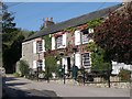
The Bolingey Inn
A village pub which dates from the 17th century.
Image: © Tony Atkin
Taken: 15 Oct 2005
0.09 miles

5
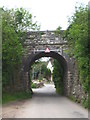
Old railway bridge at Bolingey
This bridge carried the Chacewater to Perranporth line which opened on 6th July 1903 and then extended onwards to Shepherds Station near St Newlyn East where it joined the mineral line which ran from Treamble near Rejerrah to Newquay. It was closed on 4 February 1963 as a result of the Beeching Report (thanks to Simon Glanville for this detail).
Image: © Rod Allday
Taken: 30 May 2012
0.13 miles
6
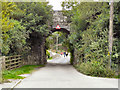
Mill Road Bolingey
The bridge on Mill Road.
Image: © David Dixon
Taken: 28 Jul 2010
0.13 miles
7
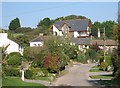
Bolingey
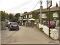
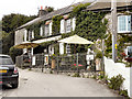
Bolingey is a very pleasant looking village about a mile to the south of Perranporth. The view from the western road into the village is dominated by an extraordinary looking building which towers above the level of the other houses. Although an attempt has been made to make it blend in with the houses below, the effect is like painting stripes on an elephant to make it blend in with the zebras.
Image: © Tony Atkin
Taken: 15 Oct 2005
0.15 miles
8
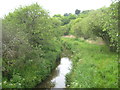
Un-named stream near Nansmellyn
Looking upstream from the bridge in New Road.
Image: © Rod Allday
Taken: 30 May 2012
0.18 miles
9
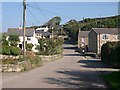
Bolingey
The main part of Bolingey village is on the western side of the valley, behind the photographer. This picture shows the smaller eastern part of the village built on the flood plain of the valley and up on the eastern side.
Image: © Tony Atkin
Taken: 15 Oct 2005
0.19 miles
10
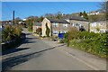
Mill Road, Bolingey, Perranzabuloe
Bolingey is close to, but retains a serparate identity from, the neighbouring Perranporth.
Image: © Andrew Smith
Taken: 3 Apr 2022
0.19 miles