Old railway bridge at Bolingey
Introduction
The photograph on this page of Old railway bridge at Bolingey by Rod Allday as part of the Geograph project.
The Geograph project started in 2005 with the aim of publishing, organising and preserving representative images for every square kilometre of Great Britain, Ireland and the Isle of Man.

There are currently over 7.5m images from over 14,400 individuals and you can help contribute to the project by visiting https://www.geograph.org.uk
Old railway bridge at Bolingey
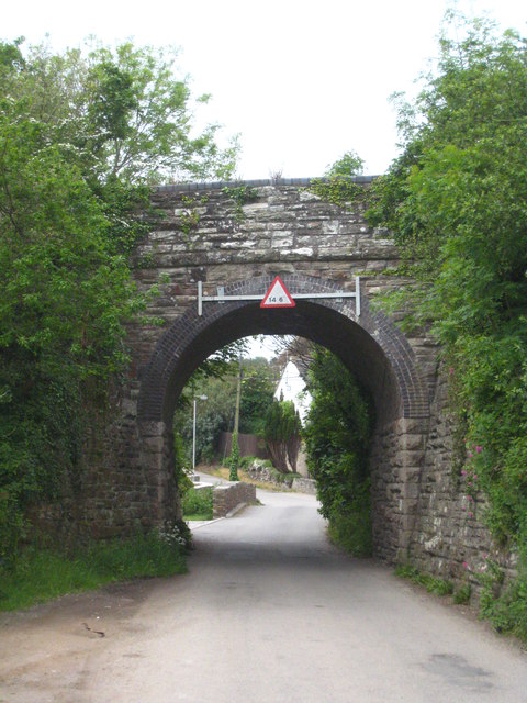
Image: © Rod Allday Taken: 30 May 2012
This bridge carried the Chacewater to Perranporth line which opened on 6th July 1903 and then extended onwards to Shepherds Station near St Newlyn East where it joined the mineral line which ran from Treamble near Rejerrah to Newquay. It was closed on 4 February 1963 as a result of the Beeching Report (thanks to Simon Glanville for this detail).
Images are licensed for reuse under creativecommons.org/licenses/by-sa/2.0
Image Location
Latitude
50.337023
Longitude
-5.142428