
IMAGES TAKEN NEAR TO
St. Buryan, PENZANCE, TR19 6BZ
Introduction
This page details the photographs taken nearby to TR19 6BZ by members of the Geograph project.
The Geograph project started in 2005 with the aim of publishing, organising and preserving representative images for every square kilometre of Great Britain, Ireland and the Isle of Man.

There are currently over 7.5m images from over14,400 individuals and you can help contribute to the project by visiting https://www.geograph.org.uk
Image Map
Images are licensed for reuse under creativecommons.org/licenses/by-sa/2.0
Notes
- Clicking on the map will re-center to the selected point.
- The higher the marker number, the further away the image location is from the centre of the postcode.
Image Listing (106 Images Found)
Images are licensed for reuse under creativecommons.org/licenses/by-sa/2.0
Image
Details
Distance
1
St Buryan from Chapel Carn Brea
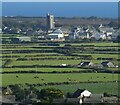
The views from the top of Chapel Carn Brea are excellent. This is looking south-eastwards to the village of St Buryan with its eponymous church. The conspicuous tower is 92' high and dates from 1501, though there has been a church on this site since at least 930AD in the reign of Æthelstan.
Even older, in a field below the tower (as viewed) is a prominent standing stone called Trevorgans Menhir at SW 40490 26132 - see Image] and Image] for much closer views of this neolithic relic.
See shared description below:
Image: © Rob Farrow
Taken: 1 Oct 2021
0.02 miles
2
Church of St Buryan
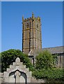
"North wall of chancel is C12, otherwise C15 and possibly early C16 ... Largely unaltered late medieval exterior, with most of the original openings ... Tall C15 4-storey embattled tower has buttresses set back from the corners; strings dividing the stages" http://www.imagesofengland.org.uk/details/default.aspx?id=69682
In the foreground is the WW1 war memorial, a "large ogee-headed arched niche containing a pierced wheel-headed cross" http://www.imagesofengland.org.uk/Details/Default.aspx?id=69697&mode=adv .
The circular churchyard probably indicates pre-Christian origin, in this case "the enclosure wall of a late Iron Age enclosed settlement".
Image: © Derek Harper
Taken: 12 Jul 2005
0.02 miles
4
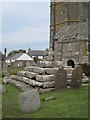
Stone cross in St Buryan churchyard
This cross is featured in the opening scenes of the film 'Straw Dogs', initially in an aerial view and then at ground level, with children playing around it.
Image: © Rod Allday
Taken: 17 Sep 2008
0.02 miles
5
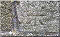
Ordnance Survey Cut Mark
This OPS cut mark can be found on the SW face of St Buryan's Church. It marks a point 124.77m above mean sea level.
Image: © Adrian Dust
Taken: 23 Feb 2017
0.02 miles
6
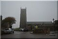
St Buryan : St Buryan Church
Looking towards the church alongside the road.
Image: © Lewis Clarke
Taken: 30 Sep 2022
0.02 miles
7
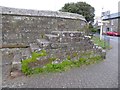
Mounting block in St Buryan
A Grade II listed mounting block in front of St Buryan church. It's thought to date from the 18th or early 19th century. https://historicengland.org.uk/listing/the-list/list-entry/1143889
Image: © Philip Halling
Taken: 6 Nov 2017
0.02 miles
8
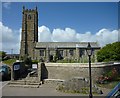
St. Buryan church from an open-top bus
Taken from an open-top bus stopping here on its route from Porthcurno to Penzance.
Image: © Maurice D Budden
Taken: 8 Jun 2011
0.03 miles
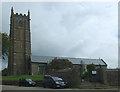
10
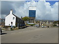
Wrapped in blue
The church tower of St Buryan's church clad in scaffolding and polythene during restoration work on the tower.
Image: © Anthony Vosper
Taken: 9 Apr 2019
0.03 miles