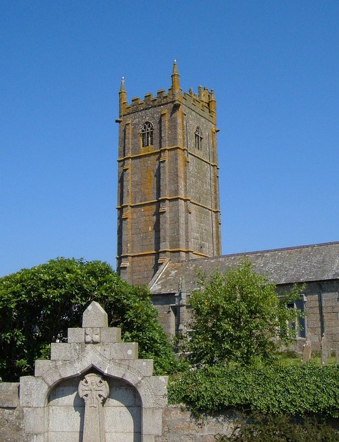
Church of St Buryan
Introduction
The photograph on this page of Church of St Buryan by Derek Harper as part of the Geograph project.
The Geograph project started in 2005 with the aim of publishing, organising and preserving representative images for every square kilometre of Great Britain, Ireland and the Isle of Man.
There are currently over 7.5m images from over 14,400 individuals and you can help contribute to the project by visiting https://www.geograph.org.uk

Image: © Derek Harper Taken: 12 Jul 2005
"North wall of chancel is C12, otherwise C15 and possibly early C16 ... Largely unaltered late medieval exterior, with most of the original openings ... Tall C15 4-storey embattled tower has buttresses set back from the corners; strings dividing the stages" http://www.imagesofengland.org.uk/details/default.aspx?id=69682 In the foreground is the WW1 war memorial, a "large ogee-headed arched niche containing a pierced wheel-headed cross" http://www.imagesofengland.org.uk/Details/Default.aspx?id=69697&mode=adv . The circular churchyard probably indicates pre-Christian origin, in this case "the enclosure wall of a late Iron Age enclosed settlement".

