St Buryan from Chapel Carn Brea
Introduction
The photograph on this page of St Buryan from Chapel Carn Brea by Rob Farrow as part of the Geograph project.
The Geograph project started in 2005 with the aim of publishing, organising and preserving representative images for every square kilometre of Great Britain, Ireland and the Isle of Man.

There are currently over 7.5m images from over 14,400 individuals and you can help contribute to the project by visiting https://www.geograph.org.uk
St Buryan from Chapel Carn Brea
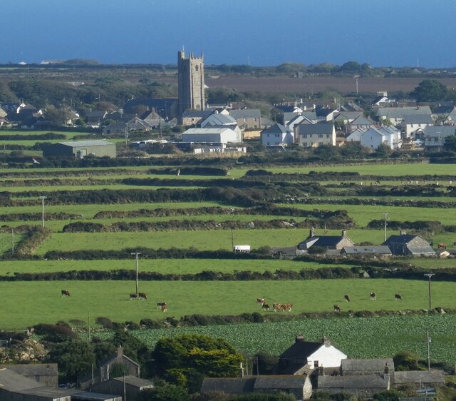
Image: © Rob Farrow Taken: 1 Oct 2021
The views from the top of Chapel Carn Brea are excellent. This is looking south-eastwards to the village of St Buryan with its eponymous church. The conspicuous tower is 92' high and dates from 1501, though there has been a church on this site since at least 930AD in the reign of Æthelstan. Even older, in a field below the tower (as viewed) is a prominent standing stone called Trevorgans Menhir at SW 40490 26132 - see Image] and Image] for much closer views of this neolithic relic. See shared description below:
Images are licensed for reuse under creativecommons.org/licenses/by-sa/2.0
Image Location
Latitude
50.075079
Longitude
-5.622911