IMAGES TAKEN NEAR TO
Portreath, REDRUTH, TR16 4PF
Introduction
This page details the photographs taken nearby to TR16 4PF by members of the Geograph project.
The Geograph project started in 2005 with the aim of publishing, organising and preserving representative images for every square kilometre of Great Britain, Ireland and the Isle of Man.

There are currently over 7.5m images from over14,400 individuals and you can help contribute to the project by visiting https://www.geograph.org.uk
Image Map
Images are licensed for reuse under creativecommons.org/licenses/by-sa/2.0
Notes
- Clicking on the map will re-center to the selected point.
- The higher the marker number, the further away the image location is from the centre of the postcode.
Image Listing (18 Images Found)
Images are licensed for reuse under creativecommons.org/licenses/by-sa/2.0
Image
Details
Distance
1
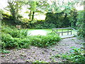
Feadon Farm pond
The pond is attached to the adjacent Feadon Farm wildlife and educational centre http://www.feadonfarmwildlife.co.uk/ and was rescued from a state of some dereliction; it now has a population of dragonflies, butterflies, newts and toads, and assorted native plants.
Image: © Richard Law
Taken: 21 Sep 2012
0.07 miles
2
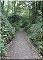
Public footpath
This steep footpath rises from near the eastern end of Primrose Terrace in Portreath and climbs up through woodland to Feadon Farm http://www.feadonfarmwildlife.co.uk/ , which is just a short distance ahead.
For a photograph taken near the start of this right of way, click here Image
Image: © Alan Walker
Taken: 29 Aug 2017
0.09 miles
3
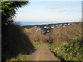
Course of former railway at Portreath
This track follows the line of the Portreath branchline of the Hayle Railway, which enabled coal brought into Portreath harbour to be transported via a steep incline (ahead of this view) to the mining areas of Camborne and Pool.
Image: © Rod Allday
Taken: 7 Dec 2008
0.10 miles
5
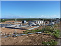
Housing developments on the south side of Portreath
New build work in progress on the Tregea Parc developmnets, near Trigea Manor.
Image: © Richard Law
Taken: 19 Sep 2012
0.18 miles
6
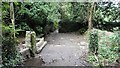
Illogan Woods
This north-westerly facing photograph shows the northern end of a public footpath Illogan Woods as it approaches Primrose Terrace in Portreath.
For another photograph of the footpath taken some 550m behind the viewpoint, click here Image
Image: © Alan Walker
Taken: 29 Aug 2017
0.20 miles
7
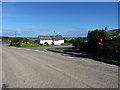
Housing on the southern side of Portreath
The estate road is Porthvean. Further development is taking place just to the southeast of here Image, but is not yet mapped (in 2012)
Image: © Richard Law
Taken: 19 Sep 2012
0.20 miles
8
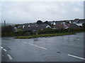
B3301 junction with road to Illogan near Portreath.
Image: © Colin Pyle
Taken: 6 Apr 2010
0.21 miles
9
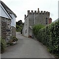
Public right of way
This steep lane carries the start of a public footpath from near the eastern end of Primrose Terrace in Portreath.
A short distance ahead the footpath leaves the metalled surface and climbs up through woodland to Feadon Farm http://www.feadonfarmwildlife.co.uk/ .
For a photograph taken ahead, near to the end of this right of way, click here Image
The castellated building is Portreath Gazebo. For more information, see this photograph by Alan Terrill Image
Image: © Alan Walker
Taken: 29 Aug 2017
0.22 miles