
IMAGES TAKEN NEAR TO
Rack Park Road, KINGSBRIDGE, TQ7 1DH
Introduction
This page details the photographs taken nearby to Rack Park Road, TQ7 1DH by members of the Geograph project.
The Geograph project started in 2005 with the aim of publishing, organising and preserving representative images for every square kilometre of Great Britain, Ireland and the Isle of Man.

There are currently over 7.5m images from over14,400 individuals and you can help contribute to the project by visiting https://www.geograph.org.uk
Image Map
Images are licensed for reuse under creativecommons.org/licenses/by-sa/2.0
Notes
- Clicking on the map will re-center to the selected point.
- The higher the marker number, the further away the image location is from the centre of the postcode.
Image Listing (24 Images Found)
Images are licensed for reuse under creativecommons.org/licenses/by-sa/2.0
Image
Details
Distance
1
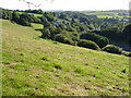
View down Washbrook valley
From the byway / green lane above Washabrook Mill, looking towards the valley's junction with the head of the Kingsbridge estuary.
Image: © Derek Harper
Taken: 24 Aug 2006
0.10 miles
2
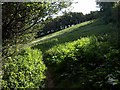
Meadow near Garden Mill, Kingsbridge
Kingsbridge Footpath 6 climbs the right side of this steep triangular meadow, linking Derby Road with High House Lane.
Image: © Derek Harper
Taken: 1 Oct 2009
0.14 miles
3
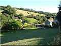
Washbrook
Washabrook (sic) Mill and Washbrook Farm on either side of the stream down the Washbrook valley.
Image: © Derek Harper
Taken: 24 Aug 2006
0.15 miles
4
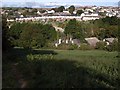
Washbrook valley, Kingsbridge
Looking across the Garden Mill industrial estate in the lower part of the valley from Kingsbridge Footpath 6, near the top of Image The housing along Rack Park Road on the hillside beyond is in Image
Image: © Derek Harper
Taken: 1 Oct 2009
0.16 miles
5
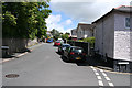
Kingsbridge: Rack Park Road
Rack Park suggests a rack field where cloth was stretched on racks fitted with tenterhooks after being fulled in a tucking mill. Nearby Garden Mill, off Derby Road, was a water-powered grain mill in the 19th century, as was the 18th century Saltmill, also close by
Image: © Martin Bodman
Taken: 3 Jul 2008
0.17 miles
6
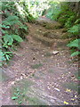
Byway from Washabrook Mill to Shindle Mill
An old route but newly-declared a public byway, this steep track just above Washabrook Mill exposes a rock base.
Image: © Derek Harper
Taken: 24 Aug 2006
0.18 miles
7
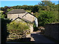
Washabrook Mill
Former watermill in a valley just east of Kingsbridge.
Image: © Derek Harper
Taken: 24 Aug 2006
0.19 miles
8
![Kingsbridge houses [29]](https://s0.geograph.org.uk/geophotos/07/57/79/7577940_15b7deb0_120x120.jpg)
Kingsbridge houses [29]
Pindar Lodge, The Promenade, is set back from the road. The house was mostly rebuilt circa 1800. Constructed of stuccoed stone under a hipped slate roof. The house is the birthplace of the 18th century poet John Wolcot, known as Peter Pindar. Listed, grade II, with details at: https://historicengland.org.uk/listing/the-list/list-entry/1249461
Kingsbridge is a market town in the South Hams district of Devon. It is located at the head of an estuary some 17 miles southwest of Torquay and about 17 miles southeast of Plymouth. The town formed around a bridge built in or before the 10th century between two royal estates, giving it the name of Kyngysbrygge ("King's bridge"). Situated in the South Devon Area of Outstanding Natural Beauty and close to the South Devon coast, the town is a popular tourist destination.
Image: © Michael Dibb
Taken: 25 Jun 2023
0.23 miles
9
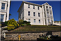
Kingsbridge : Churston Court
Churston Court on the Promenade in Kingsbridge.
Image: © Lewis Clarke
Taken: 17 Jul 2015
0.23 miles
10
![Kingsbridge houses [30]](https://s3.geograph.org.uk/geophotos/07/57/79/7577947_523983d2_120x120.jpg)
Kingsbridge houses [30]
Numbers 1 to 8, Victoria Place, occupy a pair of houses built circa 1835. Constructed of stuccoed stone under a hipped slate roof. Listed, grade II, with details at: https://historicengland.org.uk/listing/the-list/list-entry/1249488
Kingsbridge is a market town in the South Hams district of Devon. It is located at the head of an estuary some 17 miles southwest of Torquay and about 17 miles southeast of Plymouth. The town formed around a bridge built in or before the 10th century between two royal estates, giving it the name of Kyngysbrygge ("King's bridge"). Situated in the South Devon Area of Outstanding Natural Beauty and close to the South Devon coast, the town is a popular tourist destination.
Image: © Michael Dibb
Taken: 25 Jun 2023
0.23 miles