
IMAGES TAKEN NEAR TO
Bakers Hill, BRIXHAM, TQ5 0BS
Introduction
This page details the photographs taken nearby to Bakers Hill, TQ5 0BS by members of the Geograph project.
The Geograph project started in 2005 with the aim of publishing, organising and preserving representative images for every square kilometre of Great Britain, Ireland and the Isle of Man.

There are currently over 7.5m images from over14,400 individuals and you can help contribute to the project by visiting https://www.geograph.org.uk
Image Map
Images are licensed for reuse under creativecommons.org/licenses/by-sa/2.0
Notes
- Clicking on the map will re-center to the selected point.
- The higher the marker number, the further away the image location is from the centre of the postcode.
Image Listing (66 Images Found)
Images are licensed for reuse under creativecommons.org/licenses/by-sa/2.0
Image
Details
Distance
1
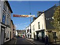
Cowtown, Brixham
The last stretch of Drew Street. The telephone box is on the corner of Horsepool Street and is in Image Milton Street continues ahead, slightly to the left. The banner advertises "Brixham Hapinin: a big party".
Image: © Derek Harper
Taken: 4 Sep 2011
0.02 miles
2
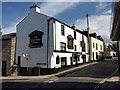
Waterman's Arms, Brixham
The corner of the pub appears in Image The building dates from the C17 http://www.britishlistedbuildings.co.uk/en-383606-watermans-arms-public-house-105-brixham .
Image: © Derek Harper
Taken: 4 Sep 2011
0.02 miles
3
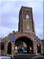
St Mary the Virgin, Higher Brixham
An interesting entrance to the grounds of St Mary the Virgin, Higher Brixham
Image: © Tom Jolliffe
Taken: 15 Mar 2007
0.02 miles
4
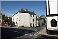
St Mary's Square, Brixham
The junction visible in Image and also shown in Image and the very similar Image; Horsepool Street runs down to the right (see Image). The pub on the right is the Waterman's Arms. The telephone kiosk is listed http://www.britishlistedbuildings.co.uk/en-383722-k6-telephone-kiosk-in-centre-of-square-b , as is the central terrace running away along the side of the square http://www.britishlistedbuildings.co.uk/en-383721-1-5-brixham . This is at the heart of "Cowtown".
Image: © Derek Harper
Taken: 4 Sep 2011
0.03 miles
5
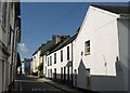
Milton Street, Brixham
From the junction shown in Image; this is the road to the left, leading towards Kingswear. Several houses here are listed; the lower-roofed houses in the centre, for instance, are "early C19, probably a
remodelling of a C17 or C18 structure" http://www.britishlistedbuildings.co.uk/en-383662-1-and-3-brixham .
Image: © Derek Harper
Taken: 4 Sep 2011
0.03 miles
6
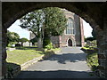
View through Lychgate, St Mary's Church
The lych gate at St Mary's Church is a substantial stone structure. The main entrance gate has an archway, through which this view is taken. The gravestones can be seen inside on either side of the main pathway to the church. The word lychgate comes from the Old English "lic" meaning a corpse, hence a gate to a graveyard. In the Middle Ages the dead were taken to the lych gate and the priest began the funeral service underneath. Lych gates always have a roof. This one is an elaborate version. I think it is an interesting example. Also see Image] and Image]
Image: © Tom Jolliffe
Taken: 25 Sep 2010
0.03 miles
7
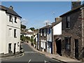
Horsepool Street, Brixham
Taken a few yards left of Image, and looking down the street to the right. On the left is the end terrace of http://www.britishlistedbuildings.co.uk/en-383721-1-5-brixham .
Image: © Derek Harper
Taken: 4 Sep 2011
0.04 miles
8

Lych gate, St Mary's Church, Brixham
This elaborate lych gate is a substantial construction. It is a mixture of styles. It appears, from the evidence of an ancient photograph, to be a remodelled remnant of a row of buildings or houses which used to be in the current position. This would account for its odd mixture of styles and openings.
Image: © Tom Jolliffe
Taken: 25 Sep 2010
0.04 miles
9

Brixham : St Mary the Virgin
Looking across to St Mary the Virgin.
Image: © Lewis Clarke
Taken: 10 Nov 2020
0.04 miles
10
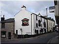
The Waterman's Arms, Drew Street, Brixham
A popular pub in the heart of Higher Brixham, near to St Mary's Church.
Image: © Tom Jolliffe
Taken: 15 Mar 2007
0.04 miles