St Mary's Square, Brixham
Introduction
The photograph on this page of St Mary's Square, Brixham by Derek Harper as part of the Geograph project.
The Geograph project started in 2005 with the aim of publishing, organising and preserving representative images for every square kilometre of Great Britain, Ireland and the Isle of Man.

There are currently over 7.5m images from over 14,400 individuals and you can help contribute to the project by visiting https://www.geograph.org.uk
St Mary's Square, Brixham
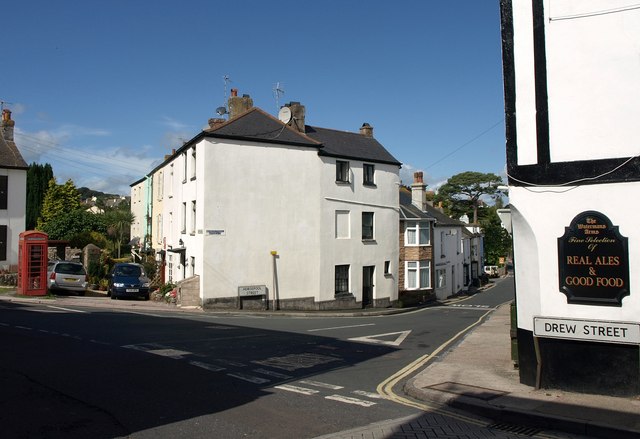
Image: © Derek Harper Taken: 4 Sep 2011
The junction visible in Image and also shown in Image and the very similar Image; Horsepool Street runs down to the right (see Image). The pub on the right is the Waterman's Arms. The telephone kiosk is listed http://www.britishlistedbuildings.co.uk/en-383722-k6-telephone-kiosk-in-centre-of-square-b , as is the central terrace running away along the side of the square http://www.britishlistedbuildings.co.uk/en-383721-1-5-brixham . This is at the heart of "Cowtown".
Images are licensed for reuse under creativecommons.org/licenses/by-sa/2.0
Image Location
Latitude
50.385928
Longitude
-3.520646