
IMAGES TAKEN NEAR TO
Newton Road, TEIGNMOUTH, TQ14 9SD
Introduction
This page details the photographs taken nearby to Newton Road, TQ14 9SD by members of the Geograph project.
The Geograph project started in 2005 with the aim of publishing, organising and preserving representative images for every square kilometre of Great Britain, Ireland and the Isle of Man.

There are currently over 7.5m images from over14,400 individuals and you can help contribute to the project by visiting https://www.geograph.org.uk
Image Map
Images are licensed for reuse under creativecommons.org/licenses/by-sa/2.0
Notes
- Clicking on the map will re-center to the selected point.
- The higher the marker number, the further away the image location is from the centre of the postcode.
Image Listing (47 Images Found)
Images are licensed for reuse under creativecommons.org/licenses/by-sa/2.0
Image
Details
Distance
1
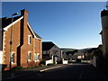
Mitre Close, Bishopsteignton
A recent housing development on Forder Lane, almost opposite the older Image
Image: © Derek Harper
Taken: 27 Jan 2008
0.04 miles
2
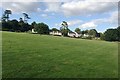
Housing along The Drive, Bishopsteignton
The Drive led from the Newton Road to a large Victorian villa built in 1840, named as Hollowmead on a map of 1889 but now known as Bishopsteignton House. The big cedars around it are a legacy of its time as a private dwelling. It is now a care home that offers "exclusive accommodation for 27 residents" http://devoncaregroup.co.uk/pages/our-homes/our-homes-%3Cbr%3Ebisopsteignton-house,-bishopsteignton/89 . Other parts of the property have been developed for housing, seen here from the grassy open space that appears once to have been a pasture or paddock overlooked by the house Image
Image: © Robin Stott
Taken: 20 Jul 2019
0.05 miles
4
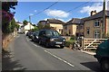
Two-tone brick houses, Forder Lane, Bishopsteignton
The cream brick is very likely from Kingsteignton, made of clay from the Teign valley claypits. At upper left are West Town Cottages. The wall postbox, left, has the ID TQ14 38D. "A 4.00pm or later collection is made from the Postbox at Bishopsteignton Post Office, 50 Fore Street." Also on the left is the turning into Littlefield. Note the 'School' sign: it has been pointed out that it's a curious hybrid - a modern (post-Worboys) triangular sign mounted on an old black and white striped pole.
Image: © Robin Stott
Taken: 20 Jul 2019
0.08 miles
5
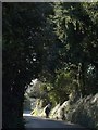
Forder Lane, Bishopsteignton
This section of Forder Lane is lined with high trees, which hide the fact that it is largely surrounded by modern housing development.
Image: © Derek Harper
Taken: 27 Jan 2008
0.08 miles
6
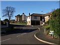
Murley Grange, Bishopsteignton
To the west of Bishopsteignton village centre, new housing has appeared, often on the site of demolished large houses. Murley Grange was replaced by this development in 1989. This lies just outside the conservation area which has been established to try and conserve what remains of the village's traditional character. Seen from Forder Lane.
Image: © Derek Harper
Taken: 27 Jan 2008
0.09 miles
7
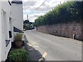
Forder Lane at West Town Cottages, Bishopsteignton
The four cottages are on the left. The turning to Littlefield is just visible past the bend. The entry to Footpath No.19 is behind the camera.
Image: © Robin Stott
Taken: 20 Jul 2019
0.10 miles
8
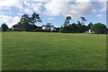
Public open space off The Drive, Bishopsteignton
This grassy slope appears to have been a pasture or paddock on the Bishopsteignton House property, pictured. It is a large Victorian villa built in 1840, named as Hollowmead on a map of 1889. The big cedars around it are a legacy of its time as a private house. It is now a care home that offers "exclusive accommodation for 27 residents" http://devoncaregroup.co.uk/pages/our-homes/our-homes-%3Cbr%3Ebisopsteignton-house,-bishopsteignton/89 . Other parts of the property have been developed for housing, glimpsed on the right Image
Image: © Robin Stott
Taken: 20 Jul 2019
0.10 miles
9
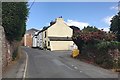
West Town Cottages, Forder Lane, Bishopsteignton
Nos 1 and 2 (furthest) are listed grade II https://historicengland.org.uk/listing/the-list/list-entry/1147821
Image: © Robin Stott
Taken: 20 Jul 2019
0.10 miles
10
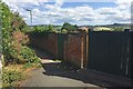
Gates by Footpath No.19, Bishopsteignton
The partly-open green gate allowed the view of the derelict nursery Image
Image: © Robin Stott
Taken: 20 Jul 2019
0.11 miles