Public open space off The Drive, Bishopsteignton
Introduction
The photograph on this page of Public open space off The Drive, Bishopsteignton by Robin Stott as part of the Geograph project.
The Geograph project started in 2005 with the aim of publishing, organising and preserving representative images for every square kilometre of Great Britain, Ireland and the Isle of Man.

There are currently over 7.5m images from over 14,400 individuals and you can help contribute to the project by visiting https://www.geograph.org.uk
Public open space off The Drive, Bishopsteignton
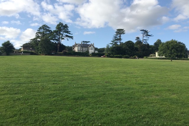
Image: © Robin Stott Taken: 20 Jul 2019
This grassy slope appears to have been a pasture or paddock on the Bishopsteignton House property, pictured. It is a large Victorian villa built in 1840, named as Hollowmead on a map of 1889. The big cedars around it are a legacy of its time as a private house. It is now a care home that offers "exclusive accommodation for 27 residents" http://devoncaregroup.co.uk/pages/our-homes/our-homes-%3Cbr%3Ebisopsteignton-house,-bishopsteignton/89 . Other parts of the property have been developed for housing, glimpsed on the right Image
Images are licensed for reuse under creativecommons.org/licenses/by-sa/2.0
Image Location


Leaflet Map data © OpenStreetMap
Latitude
50.55057
Longitude
-3.550358