IMAGES TAKEN NEAR TO
Inverteign Drive, TEIGNMOUTH, TQ14 9AF
Introduction
This page details the photographs taken nearby to Inverteign Drive, TQ14 9AF by members of the Geograph project.
The Geograph project started in 2005 with the aim of publishing, organising and preserving representative images for every square kilometre of Great Britain, Ireland and the Isle of Man.

There are currently over 7.5m images from over14,400 individuals and you can help contribute to the project by visiting https://www.geograph.org.uk
Image Map
Images are licensed for reuse under creativecommons.org/licenses/by-sa/2.0
Notes
- Clicking on the map will re-center to the selected point.
- The higher the marker number, the further away the image location is from the centre of the postcode.
Image Listing (277 Images Found)
Images are licensed for reuse under creativecommons.org/licenses/by-sa/2.0
Image
Details
Distance
1
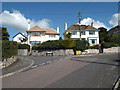
Early houses in Inverteign Drive, Teignmouth
These houses first appear on the 1933-36 OS 1:2500 map, thus they are among the first to be built in Inverteign, as the road was originally called. A view from further back is Image
Image: © Robin Stott
Taken: 8 Jul 2014
0.04 miles
2
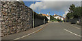
Inverteign, Teignmouth
Image: © Derek Harper
Taken: 6 Oct 2019
0.04 miles
3
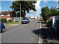
Lower end of Kingsway, Teignmouth
A group of lock-up garages sits beside a conventional brick council house, left.
Image: © Robin Stott
Taken: 8 Jul 2014
0.05 miles
4
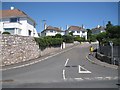
South end of Inverteign, west Teignmouth
Inverteign and its continuation Inverteign Drive are lined with detached houses climbing the hill to the north of Bishopsteignton Road. A map of 1933 shows the development being laid out; by 1955 half the houses were built. A map of the 1960s shows it complete. Until then it had always been Inverteign; at some time during the 1970s it was renamed Inverteign Drive. The view to the right is Image
Image: © Robin Stott
Taken: 6 Jul 2013
0.05 miles
5
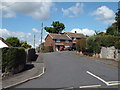
Houses and postbox, lower end of Kingsway, Teignmouth
It looks as though Kingsway starts at the bend, so these are the first houses in that road. The house whose garden gate appears on the far right probably clings to an Inverteign Drive address: Kingsway is mostly council or former council housing. Postbox is no.TQ14 11.
Image: © Robin Stott
Taken: 8 Jul 2014
0.06 miles
6
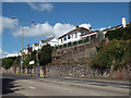
Houses in Inverteign Drive overlooking Bitton Park Road, Teignmouth
Just before the traffic lights at the junction with the A379 Torquay Road. The white house at far left is called 'Fort Inverteign' currently. It was the first house in Inverteign, the road's original name, when it first appears on the OS map of 1933-36. The retaining walls may have been built at the same time: comparing OS maps for 1905 and 1933 suggests that Bitton Park Road/Bishopsteignton Road between Mill Lane and the bend west of Shaldon Bridge was widened on both sides.
Image: © Robin Stott
Taken: 8 Jul 2014
0.06 miles
7
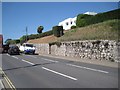
Retaining wall to Bishopsteignton Road below Inverteign Drive, Teignmouth
Comparing OS maps for 1905 and 1933 suggests that Bishopsteignton Road between Mill Lane and the bend west of Shaldon Bridge was widened on both sides. This retaining wall (probably concrete faced with Devonian limestone) holds back the hillside and holds up the gardens of the properties along Inverteign above which was possibly being developed from the late 1920s. This wall is certainly more weathered than, say, the retaining walls to villa gardens along Bitton Park Road east of Coombe Vale Road.
Image: © Robin Stott
Taken: 6 Jul 2013
0.06 miles
8
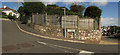
Inverteign, Teignmouth
You can see the left side of this image at Image On the right is the A381 approaching the junction with the A379 by Teignmouth & Shaldon Bridge.
Image: © Derek Harper
Taken: 6 Oct 2019
0.07 miles