IMAGES TAKEN NEAR TO
Moretonhampstead, NEWTON ABBOT, TQ13 8PR
Introduction
This page details the photographs taken nearby to TQ13 8PR by members of the Geograph project.
The Geograph project started in 2005 with the aim of publishing, organising and preserving representative images for every square kilometre of Great Britain, Ireland and the Isle of Man.

There are currently over 7.5m images from over14,400 individuals and you can help contribute to the project by visiting https://www.geograph.org.uk
Image Map
Images are licensed for reuse under creativecommons.org/licenses/by-sa/2.0
Notes
- Clicking on the map will re-center to the selected point.
- The higher the marker number, the further away the image location is from the centre of the postcode.
Image Listing (10 Images Found)
Images are licensed for reuse under creativecommons.org/licenses/by-sa/2.0
Image
Details
Distance
1
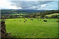
Howton cattle - Moretonhampstead
Cattle are commonly found in this area. Dartmoor on the horizon.
Image: © Fiona Avis
Taken: 23 Oct 2005
0.05 miles
3
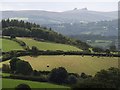
Countryside near Howton
A view southwards from Moretonhampstead Bridleway 9. The lane crossing the image is from Butterdon to Sandhill Cross, and the woodland at the back is at Trips. In the distance are the double rocks of Hay Tor.
Image: © Derek Harper
Taken: 3 Sep 2009
0.17 miles
4
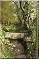
Footpath to Moretonhampstead
Moretonhampstead Footpath 10 crosses the lane between Howton and Butterdon here, heading south via this interesting atone stile and running along the edge of a wood.
Image: © Derek Harper
Taken: 27 Mar 2017
0.21 miles
5
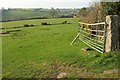
Towards Bowden
Taken just around the corner shown in Image], looking right, with Moretonhampstead Footpath 10 behind the hedge on the right. The farm at Bowden, across the valley, is just into Image
Image: © Derek Harper
Taken: 27 Mar 2017
0.23 miles
7
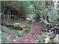
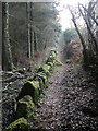
Path through woods near Coombe Court
The path is lined on one side by a hedge, on the other by an edge of granite, now covered with moss.
Image: © David Smith
Taken: 23 Sep 2011
0.24 miles
8
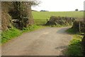
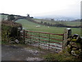
Footpath crossing lane south of Butterdon
On the left is Image, with Moretonhampstead Footpath 10 running southwards. It runs northwards on the right towards Bowden Farm. The lane continues towards Howton.
Image: © Derek Harper
Taken: 27 Mar 2017
0.24 miles
9
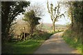
Lane to Butterdon
A reverse view of Image], with Moretonhampstead Footpath 10 signed to the left.
Image: © Derek Harper
Taken: 27 Mar 2017
0.24 miles