1
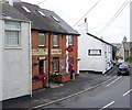
Date stone, Post Office, Chudleigh Knighton
The date stone is on the corner of the post office.
Image: © Maigheach-gheal
Taken: 17 Aug 2008
0.04 miles
2
Village facilities, Chudleigh Knighton
The shop and post office with the hairdressers beyond.
Image: © Maigheach-gheal
Taken: 17 Aug 2008
0.04 miles
3
Chudleigh Knighton Village Hall and pub
Looking along the road that leads to Chudleigh or Newton Abbot, the village hall and Chudleigh Knighton pre-school are on the left while "The Anchor" pub is on the right.
Image: © paul dickson
Taken: 31 Mar 2008
0.04 miles
4
Homelea, Chudleigh Knighton
The main street of the village with village stores and off licence, recycling bank and hair salon on one side
Image: © David Smith
Taken: 15 Jul 2020
0.05 miles
5
The Anchor Inn, Chudleigh Knighton
Image: © Ian S
Taken: 26 May 2013
0.05 miles
6
The Anchor Inn, Chudleigh Knighton
Image: © Ian S
Taken: 26 May 2013
0.05 miles
7
Chudleigh Knighton Pre-School
The pre-school is in the village hall, seen from the other direction in
Image
Image: © Derek Harper
Taken: 17 Feb 2009
0.05 miles
8
Post Office in Chudleigh Knighton
On the left are post office and village hall, and opposite is the Anchor Inn
Image: © David Smith
Taken: 12 Jul 2013
0.05 miles
9
Bus shelter and the Anchor Inn, Chudleigh Knighton
Image: © David Smith
Taken: 12 Jul 2013
0.05 miles
10
Old Guide Stone by the B3344, Chudleigh Knighton, Hennock Parish
Ashburton guidestone by the B3344 (was A38), in parish of Hennock (Teignbridge District), Chudleigh Knighton, North East of St Paul's Church at fork in road, junction of Capelry and Homelea, on verge beside water hydrant.
Inscription reads:-
: TO / BOVEY / TO / CHUDLEIGH : : TO / CHUDLEIGH / TO / ASHBURTON :
Grade II listed. List Entry Number: 1097419
https://historicengland.org.uk/listing/the-list/list-entry/1097419
Surveyed
Milestone Society National ID: DV_XHEN05
Image: © Alan Rosevear
Taken: 10 Oct 2012
0.06 miles


