Old Guide Stone by the B3344, Chudleigh Knighton, Hennock Parish
Introduction
The photograph on this page of Old Guide Stone by the B3344, Chudleigh Knighton, Hennock Parish by Alan Rosevear as part of the Geograph project.
The Geograph project started in 2005 with the aim of publishing, organising and preserving representative images for every square kilometre of Great Britain, Ireland and the Isle of Man.

There are currently over 7.5m images from over 14,400 individuals and you can help contribute to the project by visiting https://www.geograph.org.uk
Old Guide Stone by the B3344, Chudleigh Knighton, Hennock Parish
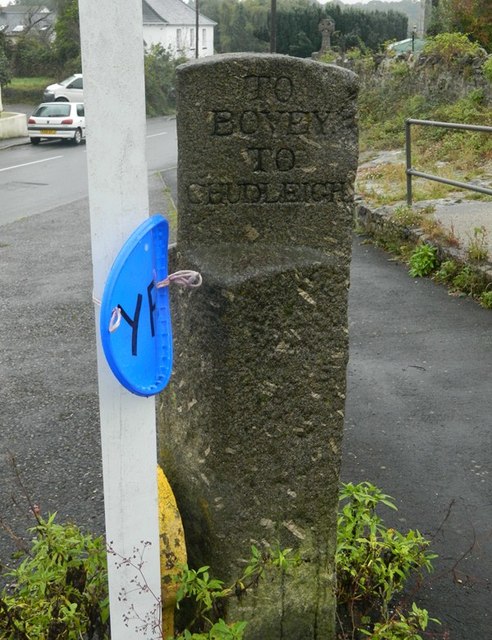
Image: © Alan Rosevear Taken: 10 Oct 2012
Ashburton guidestone by the B3344 (was A38), in parish of Hennock (Teignbridge District), Chudleigh Knighton, North East of St Paul's Church at fork in road, junction of Capelry and Homelea, on verge beside water hydrant. Inscription reads:- : TO / BOVEY / TO / CHUDLEIGH : : TO / CHUDLEIGH / TO / ASHBURTON : Grade II listed. List Entry Number: 1097419 https://historicengland.org.uk/listing/the-list/list-entry/1097419 Surveyed Milestone Society National ID: DV_XHEN05
Images are licensed for reuse under creativecommons.org/licenses/by-sa/2.0
Image Location
Latitude
50.585053
Longitude
-3.631812