IMAGES TAKEN NEAR TO
BUCKFASTLEIGH, TQ11 0LD
Introduction
This page details the photographs taken nearby to TQ11 0LD by members of the Geograph project.
The Geograph project started in 2005 with the aim of publishing, organising and preserving representative images for every square kilometre of Great Britain, Ireland and the Isle of Man.

There are currently over 7.5m images from over14,400 individuals and you can help contribute to the project by visiting https://www.geograph.org.uk
Image Map
Images are licensed for reuse under creativecommons.org/licenses/by-sa/2.0
Notes
- Clicking on the map will re-center to the selected point.
- The higher the marker number, the further away the image location is from the centre of the postcode.
Image Listing (43 Images Found)
Images are licensed for reuse under creativecommons.org/licenses/by-sa/2.0
Image
Details
Distance
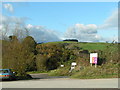
3
Wash
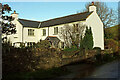
A tiny hamlet. The prominent house left of centre is shown in Image On the hill is Tor Hill Plantation. Taken from the eastern end of Staverton footpath 12.
Image: © Derek Harper
Taken: 20 Dec 2020
0.03 miles
4
Little Wash
And indeed this is what we gave our muddy boots in the streaming gutter by the lane here.
Image: © Derek Harper
Taken: 20 Dec 2020
0.03 miles
6
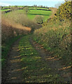
Footpath to Wash
Staverton footpath 2 drops towards the hamlet below the hillside shown in Image
Image: © Derek Harper
Taken: 20 Dec 2020
0.05 miles
7
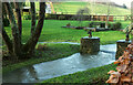
Stream at Wash
Looking right from the lane shown in Image A pair of horses' heads on piers either side of a tiny weir which helps divert water from the (currently swollen) stream around an island.
Image: © Derek Harper
Taken: 20 Dec 2020
0.06 miles
8
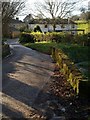
Bridge at Wash
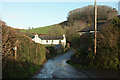
The lane from Wash Cross crosses a tributary of the Dart and passes through the tiny hamlet.
Image: © Derek Harper
Taken: 5 Dec 2008
0.06 miles
9
Near Wash
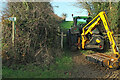
On Staverton footpath 12. The footpath sign points left along a narrow hedge-lined path; there are four much wider tracks at this point, all leading into fields, such the one shown here, whose entrance is blocked by tractor and a McConnel hedge cutter.
Image: © Derek Harper
Taken: 20 Dec 2020
0.07 miles
10
View across Wash Farm
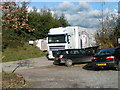
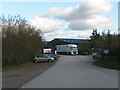
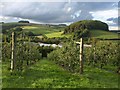
Looking past an orchard and over Riverford's Field Kitchen and other buildings, from the lane west of Bumpston Cross, with Tor Hill Plantation on the hill opposite.
Image: © Derek Harper
Taken: 25 Aug 2011
0.07 miles