IMAGES TAKEN NEAR TO
Cyprus Place, RYE, TN31 7DR

Introduction

This page details the photographs taken nearby to Cyprus Place, TN31 7DR by members of the Geograph project.

The Geograph project started in 2005 with the aim of publishing, organising and preserving representative images for every square kilometre of Great Britain, Ireland and the Isle of Man.

There are currently over 7.5m images from over14,400 individuals and you can help contribute to the project by visiting https://www.geograph.org.uk

Image Map


Images are licensed for reuse under creativecommons.org/licenses/by-sa/2.0
Notes
  • Clicking on the map will re-center to the selected point.
  • The higher the marker number, the further away the image location is from the centre of the postcode.

Image Listing (1557 Images Found)

Images are licensed for reuse under creativecommons.org/licenses/by-sa/2.0
  • ...
Image
Details
Distance
1
4-14 Cyprus Place
Image: © Oast House Archive Taken: 28 Mar 2015
0.01 miles
2
The Granary Club
This club occupies an old granary by the railway line.
Image: © N Chadwick Taken: 25 Oct 2010
0.01 miles
3
Alma Place, Rye
Image: © Chris Whippet Taken: 22 Jul 2009
0.01 miles
4
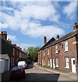
Cyprus Place, Rye
A side street linking Wish Street to Ferry Road. The terrace on the left was originally known as Alma Place that probably dates them to the 1850s or 60s. Those on the right were built sometime between 1872 and 1898.
Image: © Simon Carey Taken: 11 Apr 2019
0.01 miles
5
The Granary Club
Image: © N Chadwick Taken: 23 Jul 2020
0.01 miles
6
Cyprus Place, Rye
Image: © Chris Whippet Taken: 22 Jul 2009
0.02 miles
7
Club Horizon and Granary Club, Rye, 2014
Now closed and converted into flats and offices.
Image: © Robin Webster Taken: 29 May 2014
0.02 miles
8
Ferry Road, Rye
Part of the A268 one way system here, beyond the level crossing in the distance it becomes the B2089.
Image: © Simon Carey Taken: 11 Apr 2019
0.02 miles
9
On Wish St
Image: © N Chadwick Taken: 23 Jul 2020
0.02 miles
10
The Granary Club
On the B2089 Ferry Road, near the Marshlink Level Crossing. Previously known as the Oasis it has since closed for redevelopment into flats. https://www.ryenews.org.uk/news/granary-club-closure
Image: © Gerald England Taken: 26 Apr 2017
0.02 miles
  • ...