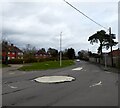
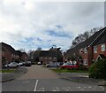
IMAGES TAKEN NEAR TO
Forest Park, UCKFIELD, TN22 2NA

Introduction

This page details the photographs taken nearby to Forest Park, TN22 2NA by members of the Geograph project.

The Geograph project started in 2005 with the aim of publishing, organising and preserving representative images for every square kilometre of Great Britain, Ireland and the Isle of Man.

There are currently over 7.5m images from over14,400 individuals and you can help contribute to the project by visiting https://www.geograph.org.uk

Image Map


Images are licensed for reuse under creativecommons.org/licenses/by-sa/2.0
Notes
  • Clicking on the map will re-center to the selected point.
  • The higher the marker number, the further away the image location is from the centre of the postcode.

Image Listing (18 Images Found)

Images are licensed for reuse under creativecommons.org/licenses/by-sa/2.0
Image
Details
Distance
1
Normans Pond
Located between Queens Drive and the Maresfield By-Pass, whose construction in the 1980s truncated its size - a small portion remains on the eastern side of the A22. The pond itself is of some antiquity being marked on Maresfield's 1840 tithe map belonging to the grounds of Maresfield Park. The pond and a section of wood to the north is now open access.
Image: © Simon Carey Taken: 16 Mar 2023
0.13 miles
2
Batts Bridge Roundabout
Where the westbound A272 leaves the A22. The A272 is straight on.
Image: © Robin Webster Taken: 22 Jan 2007
0.14 miles
3
Batts Bridge Road, Maresfield
Image: © Stacey Harris Taken: 30 Mar 2011
0.16 miles
4
A272 at Batts Bridge Roundabout
Image: © N Chadwick Taken: 4 Sep 2016
0.16 miles
5
The Wilderness
A small section of woodland that once belonged to Maresfield Park but split in two by the construction of the Maresfield By-Pass in the 1980s. This is the western portion which is now open access and showing the signs of the imminent arrival of spring.
Image: © Simon Carey Taken: 16 Mar 2023
0.17 miles
6
A22/A272 (West) Roundabout
The A272 enters extreme right and formerly continued on the route in the foreground, before the A22 Maresfield bypass was built.
Image: © Robin Webster Taken: 22 Jan 2007
0.17 miles
7
Batts Bridge Road, Maresfield
Image: © Stacey Harris Taken: 30 Mar 2011
0.17 miles
8
Old A272 into Maresfield
Before Maresfield was bypassed, the A272 entered the village by this route from the west to meet the A22 by the church.
Image: © Robin Webster Taken: 22 Jan 2007
0.19 miles
9
Batts Bridge Road, Maresfield
The current road connects the centre of the village to Maresfield Roundabout on the A22. Prior to the latter being built in the 1980s this was the A272. The houses on the right front onto The Paddock and were built in the 1990s on the site of the former Maresfield Army Camp. Those on the left were constructed between the wars on the site of another army camp that existed during the First World War.
Image: © Simon Carey Taken: 16 Mar 2023
0.19 miles
10
Maple Close, Maresfield
A cul de sac off Field End that was built in the 1990s on the site of the former Maresfield Army Camp.
Image: © Simon Carey Taken: 16 Mar 2023
0.20 miles