IMAGES TAKEN NEAR TO
Spring Lane, ETCHINGHAM, TN19 7JA
Introduction
This page details the photographs taken nearby to Spring Lane, TN19 7JA by members of the Geograph project.
The Geograph project started in 2005 with the aim of publishing, organising and preserving representative images for every square kilometre of Great Britain, Ireland and the Isle of Man.

There are currently over 7.5m images from over14,400 individuals and you can help contribute to the project by visiting https://www.geograph.org.uk
Image Map
Images are licensed for reuse under creativecommons.org/licenses/by-sa/2.0
Notes
- Clicking on the map will re-center to the selected point.
- The higher the marker number, the further away the image location is from the centre of the postcode.
Image Listing (35 Images Found)
Images are licensed for reuse under creativecommons.org/licenses/by-sa/2.0
Image
Details
Distance
1
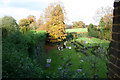
Southover Place
Overlooking the graveyard at the former seminary at Southover Place.
For 2011 photo see Image
Image: © Richard Sanders
Taken: 17 Nov 2006
0.06 miles
2
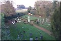
Southover Place (updated)
View looking out over the graveyard from the former seminary, Southover Place. This is an up-date of the picture I submitted in 2006 http://www.geograph.org.uk/photo/297610.
Image: © Richard Sanders
Taken: 13 Nov 2011
0.06 miles
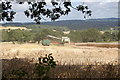
3
Mill's Meadow
The name of the field according to Burwash's 1839 tithe map located to the north of Burwash 13 Public Footpath.
Image: © Simon Carey
Taken: 26 Dec 2022
0.11 miles
4
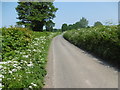
Spring Lane
This is just past the entrance to The Presbytery. This was a perfect summer's day. Cow parsley is in the road verge.
Image: © Marathon
Taken: 5 Jun 2016
0.13 miles
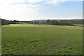
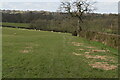
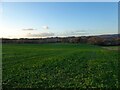
5
Hilly Field
The name of the field according to Burwash's 1839 tithe map located to the north of Burwash 13 Public Footpath.
Image: © Simon Carey
Taken: 26 Dec 2022
0.13 miles
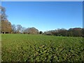
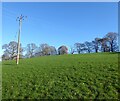
6
Upper Pilldowns
The name of the field according to Burwash's 1839 tithe map located to the south of Spring Lane and west of Holton Farm.
Image: © Simon Carey
Taken: 26 Dec 2022
0.14 miles
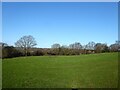
9
Good Fellow's Field (2)
The name of the field according to Burwash's 1839 tithe map. This is the larger southern section that extends down to Spring Lane. See also Image
Image: © Simon Carey
Taken: 26 Dec 2022
0.18 miles