
IMAGES TAKEN NEAR TO
Boningale Close, TELFORD, TF3 1RA
Introduction
This page details the photographs taken nearby to Boningale Close, TF3 1RA by members of the Geograph project.
The Geograph project started in 2005 with the aim of publishing, organising and preserving representative images for every square kilometre of Great Britain, Ireland and the Isle of Man.

There are currently over 7.5m images from over14,400 individuals and you can help contribute to the project by visiting https://www.geograph.org.uk
Image Map
Images are licensed for reuse under creativecommons.org/licenses/by-sa/2.0
Notes
- Clicking on the map will re-center to the selected point.
- The higher the marker number, the further away the image location is from the centre of the postcode.
Image Listing (10 Images Found)
Images are licensed for reuse under creativecommons.org/licenses/by-sa/2.0
Image
Details
Distance
1
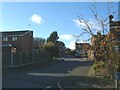
The Rowans
This housing estate was built in 1983/4. The view is up the hill looking towards Sambrook Close, Chetwynd Close and Stockton Close.
Image: © Steve McShane
Taken: 12 Nov 2005
0.06 miles
2
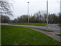
Brookside roundabout from the west
Looking from Brookside Avenue, a distributor road for the extensive housing estates of Stirchley and Brookside. The centre of the roundabout has been lightly ploughed to stimulate the growth of a wildflower meadow.
Image: © Richard Law
Taken: 27 Feb 2016
0.16 miles
3
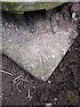
OS rivet - Brookside roundabout
An OS rivet and marker arrow in the concrete base of the large lighting tower in the centre of Image; originally levelled at 117.956m above Ordnance Datum Newlyn.
Image: © Richard Law
Taken: 27 Feb 2016
0.17 miles
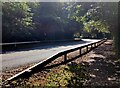
5

Stirchley Recreation Centre
View of the entrance (complete with new corporate signing) to the Sports Centre. It acts as the sports area for the adjoining school, Lord Silkin.
Image: © Steve McShane
Taken: 12 Nov 2005
0.21 miles
6
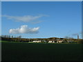
Playing Fields
The football fields run by Stirchley Recreation Centre.In the background (central) are the cottages on Stirchley Lane, and (right) Randlay Chimney.
Image: © Steve McShane
Taken: 12 Nov 2005
0.22 miles
7

Tennis Courts
Stirchley Recreation Centre run these tennis courts. Behind the tarmac area is the rugby pitch, where the local rugby league team train and play.
This picture is taken on a cool November day, and the sun was very low...
Image: © Steve McShane
Taken: 12 Nov 2005
0.23 miles
8
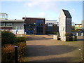
Main entrance - The Windmill primary school
At first, I couldn't work out why they call the place 'The Windmill'. Then, right outside the main entrance, all becomes clear.
Image: © Richard Law
Taken: 5 Dec 2009
0.24 miles
9
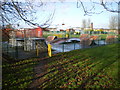
Bike park and play area, Brookside
A small play area for BMX bikes and the like, in the middle of the Brookside estate. The Windmill primary school is in the background.
Image: © Richard Law
Taken: 5 Dec 2009
0.24 miles
10
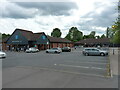
Co-op supermarket, Stirchley
The Co-op occupies the nearest building, with a couple of takeaway businesses and the like in the unit at the far side of the carpark.
Image: © Richard Law
Taken: 5 Jun 2021
0.25 miles