
IMAGES TAKEN NEAR TO
Stirchley Road, TELFORD, TF3 1EH
Introduction
This page details the photographs taken nearby to Stirchley Road, TF3 1EH by members of the Geograph project.
The Geograph project started in 2005 with the aim of publishing, organising and preserving representative images for every square kilometre of Great Britain, Ireland and the Isle of Man.

There are currently over 7.5m images from over14,400 individuals and you can help contribute to the project by visiting https://www.geograph.org.uk
Image Map
Images are licensed for reuse under creativecommons.org/licenses/by-sa/2.0
Notes
- Clicking on the map will re-center to the selected point.
- The higher the marker number, the further away the image location is from the centre of the postcode.
Image Listing (42 Images Found)
Images are licensed for reuse under creativecommons.org/licenses/by-sa/2.0
Image
Details
Distance
1
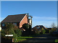
Silkin View
Well, it's not far from a view of the Silkin Way...
Modern housing with a slightly older contraption for holding telephone wires...
Image: © Steve McShane
Taken: 12 Nov 2005
0.04 miles
2
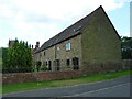
Former stables immediately to the northwest of Stirchley Hall farmhouse
A range of rubble-built stables immediately to the NW of the main former farmhouse Image; the barn dates from late 18th or early 19th century and was Grade II listed https://britishlistedbuildings.co.uk/101033304-stables-immediately-north-west-of-stirchley-hall-farmhouse-stirchley-and-brookside#.YZKZE2DP3IU & https://historicengland.org.uk/listing/the-list/list-entry/1033304 in 1983.
Image: © Richard Law
Taken: 16 Jun 2021
0.08 miles
3
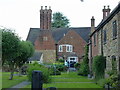
Stirchley Hall farmhouse
A rather fine 17th century house, mainly built in stone, with later brick additions. There are a number of notable interior features such as heavily moulded ceiling beams, and a chamfered fireplace bressumer beam. The place was Grade II listed https://britishlistedbuildings.co.uk/101209559-stirchley-hall-farmhouse-stirchley-and-brookside#.YZKaeWDP3IU & https://historicengland.org.uk/listing/the-list/list-entry/1209559 in 1983.
Image: © Richard Law
Taken: 16 Jun 2021
0.08 miles
4
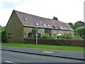
Former stables immediately to the north of Stirchley Hall farmhouse
Now converted to a number of dwellings, this former four-stable row dates from the 18th century, and was Grade II listed https://britishlistedbuildings.co.uk/101352003-stables-immediately-to-north-of-stirchley-hall-farmhouse-stirchley-and-brookside#.YZF2b2DP3IU & https://historicengland.org.uk/listing/the-list/list-entry/1352003 in 1983. it was originally part of the agricultural buildings in the yard of Image
Image: © Richard Law
Taken: 16 Jun 2021
0.09 miles
5
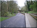
Dawley & Stirchley Station - rebuilt
On the original route of the London & North West Railway, Coalport branch; this platform was rebuilt in 2011 on the site of the original station, which closed to passengers in 1952.
The runners are participants in the 2014 Ironbridge Half Marathon, a somewhat hilly event organised by the local Telford Harriers club.
Image: © Richard Law
Taken: 6 Apr 2014
0.11 miles

8

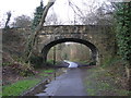
Stirchley Lane bridge
Crossing the Silen Way next to the former Dawley and Stirchley Railway Station.
The site of the former Dawley and Stirchley Railway Station, on the original route of the London & North Western Railway, Coalport branch. It closed to passengers in 1952. This platform was rebuilt in 2011 on the site of the original station. It now lies along the Silkin Way.
The Silkin Way is a 14 mile (23 km) walking and cycling route through Telford starting in Bratton and finishing in Coalport. In places the path follows the former Great Western Railway and the dry canal beds of the old Shropshire Canal. The path is named after Lewis Silkin, the Minister responsible for the post-war Labour Government's New Towns Act 1946 and Access to the Countryside Act 1949.
Image: © Mat Fascione
Taken: 1 Sep 2023
0.15 miles
9
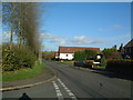
Stirchley Road
On the junction of Stirchley Lane and Stirchley Road, the road goes downhill towards the Rose And Crown pub and Stirchley Grange.
Image: © Steve McShane
Taken: 12 Nov 2005
0.16 miles
10
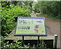
Information board at the Dawley & Stirchley Platform
The site of the former Dawley and Stirchley Railway Station, on the original route of the London & North Western Railway, Coalport branch. It closed to passengers in 1952. This platform was rebuilt in 2011 on the site of the original station. It now lies along the Silkin Way.
The Silkin Way is a 14 mile (23 km) walking and cycling route through Telford starting in Bratton and finishing in Coalport. In places the path follows the former Great Western Railway and the dry canal beds of the old Shropshire Canal. The path is named after Lewis Silkin, the Minister responsible for the post-war Labour Government's New Towns Act 1946 and Access to the Countryside Act 1949.
Image: © Mat Fascione
Taken: 1 Sep 2023
0.16 miles