
IMAGES TAKEN NEAR TO
Brimstree Drive, SHIFNAL, TF11 9PX
Introduction
This page details the photographs taken nearby to Brimstree Drive, TF11 9PX by members of the Geograph project.
The Geograph project started in 2005 with the aim of publishing, organising and preserving representative images for every square kilometre of Great Britain, Ireland and the Isle of Man.

There are currently over 7.5m images from over14,400 individuals and you can help contribute to the project by visiting https://www.geograph.org.uk
Image Map
Images are licensed for reuse under creativecommons.org/licenses/by-sa/2.0
Notes
- Clicking on the map will re-center to the selected point.
- The higher the marker number, the further away the image location is from the centre of the postcode.
Image Listing (70 Images Found)
Images are licensed for reuse under creativecommons.org/licenses/by-sa/2.0
Image
Details
Distance
1
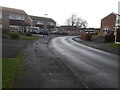
Houses on the corner of Brimstree Drive
Image: © Richard Law
Taken: 26 Dec 2020
0.01 miles
2
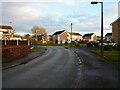
Houses on Brimstree Drive
Built, if memory serves me correctly, in the early 1970s or shortly before, and part of an estate that leads down to Image
Image: © Richard Law
Taken: 20 Dec 2020
0.04 miles
3
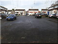
Cul de sac of housing off Brimstree Drive
Image: © Richard Law
Taken: 26 Dec 2020
0.04 miles
4
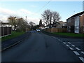
Brimstree Drive
Late 1960s housing on the southwest side of Shifnal.
Image: © Richard Law
Taken: 12 Dec 2020
0.04 miles
5
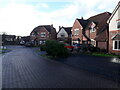
Houses around the end of Cottage Drive
The street is named for the Shifnal Cottage Hospital, which stood on this site between 1939 and 2002, for part of which period it was a nursing home. A couple of the foundation stones from the building are preserved in a nearby wall Image
Image: © Richard Law
Taken: 15 Dec 2020
0.06 miles
6
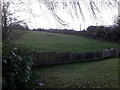
Field to the west of Brimstree Drive
A small patch of a private garden, and an open field beyond, which is pretty much in the valley of the Wesley Brook.
Image: © Richard Law
Taken: 26 Dec 2020
0.07 miles
7
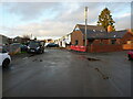
The southern end of a cul de sac off Brimstree Drive
Most of the estate houses here were built in the last 1960s or early '70s, although the red-brick place on the right here looks like a very recent addition. No brownie points for the van on the left, which is parked wholly blocking the pavement.... very inconsiderate.
Image: © Richard Law
Taken: 20 Dec 2020
0.08 miles
8
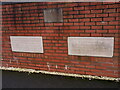
Rescued foundation stones from the old Cottage Hospital
When the houses on Cottage Drive Image were built in 2002, these two foundation stones were saved from the demolished Cottage Hospital which had stood here since the late 1930s, and were preserved by incorporation into a section of garden wall.
Image: © Richard Law
Taken: 20 Dec 2020
0.09 miles
9
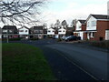
Corner of Brimstree Drive and Applebrook
The other end of Brimstree Drive near Park Lane was here when we moved to the area in the late 1960s, although it would have been quite recently built at that time. This end, with Applebrook was developed in the late 1970s, possibly early '80s.
Image: © Richard Law
Taken: 12 Dec 2020
0.10 miles
10

Wesley Brook
The brook emerges from the private domain again to pass under a substantial stone bridge bearing a footpath that connects Tanglewood Close on the left bank with Stafford Avenue on the right. We're looking upstream here, so left is right and vice versa, OK?
Image: © Mike White
Taken: 14 Jun 2009
0.11 miles