IMAGES TAKEN NEAR TO
Brick Kiln Lane, SHIFNAL, TF11 9NW
Introduction
This page details the photographs taken nearby to Brick Kiln Lane, TF11 9NW by members of the Geograph project.
The Geograph project started in 2005 with the aim of publishing, organising and preserving representative images for every square kilometre of Great Britain, Ireland and the Isle of Man.

There are currently over 7.5m images from over14,400 individuals and you can help contribute to the project by visiting https://www.geograph.org.uk
Image Map
Images are licensed for reuse under creativecommons.org/licenses/by-sa/2.0
Notes
- Clicking on the map will re-center to the selected point.
- The higher the marker number, the further away the image location is from the centre of the postcode.
Image Listing (10 Images Found)
Images are licensed for reuse under creativecommons.org/licenses/by-sa/2.0
Image
Details
Distance
1
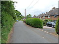
Council Houses on Brick Kiln Lane
The precise date of construction of these (council) houses isn't entirely clear. They do not appear on the 1938 maps, which suggests they are post-war.
Image: © Richard Law
Taken: 4 Jun 2020
0.01 miles
2
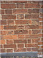
OS benchmark - Sutton Wood, house on Brick Kiln Lane
An OS cutmark, last levelled in 1979 at 102.611m above Ordnance Datum Newlyn. It's actually much older than that, as it's shown on the 1881 1:2500 map at 337.3 feet above Liverpool datum, suggesting it was cut as part of the First Primary Levelling survey of England & Wales sometime between 1840-1860.
Image: © Richard Law
Taken: 4 Jun 2020
0.05 miles
4
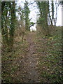
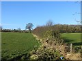
Footpath & stile in Brickkiln Coppice
Despite what the map may suggest, the footpath at the north-eastern end of Brickkiln Coppice is now inside the wood, not out in the field.
Image: © Richard Law
Taken: 6 Feb 2010
0.12 miles
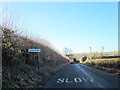
5
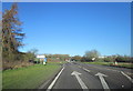
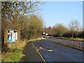
Towards Sutton Maddock
The same road looking the opposite way towards Sutton Maddock. Ahead is the Brockton/Coalport junction.
Image: © Steve McShane
Taken: 15 Apr 2006
0.17 miles
6
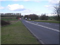
Hedge, Sutton Hill
Telford lurks over the brow of the hill. View from a layby.
Image: © Richard Webb
Taken: 16 Feb 2014
0.17 miles
10
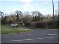
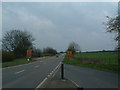
Lane to Brockton from A442.
This is a dangerous junction as traffic tends to race along the A442 in each direction. In this area there were about 60 RTA's in 2005/6 alone.
Image: © Row17
Taken: 4 Mar 2008
0.21 miles