OS benchmark - Sutton Wood, house on Brick Kiln Lane
Introduction
The photograph on this page of OS benchmark - Sutton Wood, house on Brick Kiln Lane by Richard Law as part of the Geograph project.
The Geograph project started in 2005 with the aim of publishing, organising and preserving representative images for every square kilometre of Great Britain, Ireland and the Isle of Man.

There are currently over 7.5m images from over 14,400 individuals and you can help contribute to the project by visiting https://www.geograph.org.uk
OS benchmark - Sutton Wood, house on Brick Kiln Lane
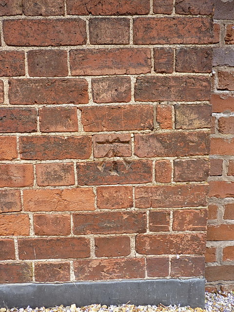
Image: © Richard Law Taken: 4 Jun 2020
An OS cutmark, last levelled in 1979 at 102.611m above Ordnance Datum Newlyn. It's actually much older than that, as it's shown on the 1881 1:2500 map at 337.3 feet above Liverpool datum, suggesting it was cut as part of the First Primary Levelling survey of England & Wales sometime between 1840-1860.
Images are licensed for reuse under creativecommons.org/licenses/by-sa/2.0
Image Location
Latitude
52.624124
Longitude
-2.427501