
IMAGES TAKEN NEAR TO
Kingfisher Close, NEWPORT, TF10 8QD
Introduction
This page details the photographs taken nearby to Kingfisher Close, TF10 8QD by members of the Geograph project.
The Geograph project started in 2005 with the aim of publishing, organising and preserving representative images for every square kilometre of Great Britain, Ireland and the Isle of Man.

There are currently over 7.5m images from over14,400 individuals and you can help contribute to the project by visiting https://www.geograph.org.uk
Image Map
Images are licensed for reuse under creativecommons.org/licenses/by-sa/2.0
Notes
- Clicking on the map will re-center to the selected point.
- The higher the marker number, the further away the image location is from the centre of the postcode.
Image Listing (8 Images Found)
Images are licensed for reuse under creativecommons.org/licenses/by-sa/2.0
Image
Details
Distance
1
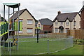
Playground beside Devana Drive
The street in the background is "Canal Close", reflecting the proximity of the former Shrewsbury and Newport Canal.
Image: © David Martin
Taken: 30 Jul 2022
0.13 miles

3
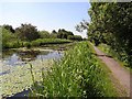
Newport Canal
The Shrewsbury and Newport Canal (which has been known variously as the Shrewsbury, and as the Newport Canal) connected Shrewsbury with the main line of the Shropshire Union Canal at Norbury Junction. The last link between Wappenshall (near Telford) and Norbury Junction through Newport was only completed in 1835. The Canal was abandoned in 1944. The section within Newport town has recently been restored as an amenity - but not as a navigable waterway.
Image: © Oliver Dixon
Taken: 17 Jun 2010
0.21 miles
4
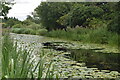
Lily pads on the former Shrewsbury and Newport Canal
Image: © David Martin
Taken: 30 Jul 2022
0.21 miles
5
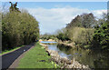
Shrewsbury & Newport Canal heading north-east
The Shrewsbury & Newport Canal has been partly restored as it passes through Newport but more as a feature in a linear park than as a navigable canal. Here the canal is seen to the north of the main part of the town, heading towards Meretown.
Image: © Trevor Littlewood
Taken: 30 Mar 2023
0.22 miles
7
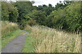
Course of former Shrewsbury and Newport Canal
In the trees ahead, the route of the canal is broken by the A41. Adjacent signs show plans for the canal's restoration which would involve construction of a new "down" and "up" lock arrangement to permit the canal to pass under the road.
Image: © David Martin
Taken: 30 Jul 2022
0.24 miles
8

Disused canal at Meretown
The Shrewsbury and Newport Canal (which has been known variously as the Shrewsbury, and as the Newport Canal) connected Shrewsbury with the main line of the Shropshire Union Canal at Norbury Junction. The last link between Wappenshall (near Telford) and Norbury Junction through Newport was only completed in 1835. The Canal was abandoned in 1944.
Image: © Oliver Dixon
Taken: 17 Jun 2010
0.24 miles