
IMAGES TAKEN NEAR TO
Barnmeadow Road, NEWPORT, TF10 7NP
Introduction
This page details the photographs taken nearby to Barnmeadow Road, TF10 7NP by members of the Geograph project.
The Geograph project started in 2005 with the aim of publishing, organising and preserving representative images for every square kilometre of Great Britain, Ireland and the Isle of Man.

There are currently over 7.5m images from over14,400 individuals and you can help contribute to the project by visiting https://www.geograph.org.uk
Image Map
Images are licensed for reuse under creativecommons.org/licenses/by-sa/2.0
Notes
- Clicking on the map will re-center to the selected point.
- The higher the marker number, the further away the image location is from the centre of the postcode.
Image Listing (13 Images Found)
Images are licensed for reuse under creativecommons.org/licenses/by-sa/2.0
Image
Details
Distance
2
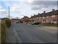
Meadow Road, Newport
1950s & 60s housing on the Audley estate on the east side of Newport.
Image: © Richard Law
Taken: 4 Apr 2013
0.18 miles
3
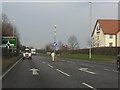
A41 at Mere Park
The large building on the right is a Travelodge motel.
Image: © Peter Whatley
Taken: 17 Jan 2012
0.20 miles
4
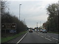
A41 at Mere Park Garden Centre
The roundabout for the A518 toward Stafford is immediately beyond the garden centre.
Image: © Peter Whatley
Taken: 29 Nov 2011
0.20 miles
5
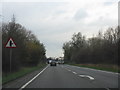
A41 approaching Mere Park Garden Centre
Image: © Peter Whatley
Taken: 29 Nov 2011
0.21 miles
6

Mere Park Garden Centre
Off the A518, near Newport Shropshire.
Image: © Eirian Evans
Taken: 5 Jun 2006
0.21 miles
7
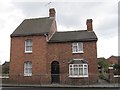
Old Toll House, Stafford Road, Newport
Toll House in the parish of Newport, at 46, Stafford Road.
Shropshire HER.
HER Number (PRN): 15336. https://www.heritagegateway.org.uk/Gateway/Results_Single.aspx?uid=MSA17239&resourceID=1015
To be surveyed
Milestone Society National ID: SA.NPT
Image: © Milestone Society
Taken: Unknown
0.22 miles
8
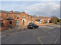
Audley House - the western end
This end of the buildings of Audley Court was the original Newport Poor Law Union Workhouse http://www.workhouses.org.uk/NewportSalop/ which was built in the mid 1850s, but is now converted to residential use. At the eastern end, the original workhouse was extended in 1908 with a 29-bed infirmary, which is partly visible in Image, and which is now part of residential facility operated by the Combat Stress charity for ex-forces personnel.
Image: © Richard Law
Taken: 4 Apr 2013
0.23 miles
9
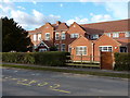
Audley Court - the eastern end
Formerly a care home for the elderly and before that the infirmary of the Newport Poor Law Union Workhouse, Audley Court now serves as a residential facility for ex-service personnel, and is operated by the Combat Stress charity.
http://www.combatstress.org.uk/veterans/contact-us/audley-court,-shropshire/
Image: © Richard Law
Taken: 4 Apr 2013
0.24 miles
10
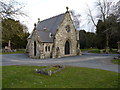
Chapel of Remembrance in the Newport cemetery
A small, stone-built chapel in the centre of the town's cemetery.
Image: © Richard Law
Taken: 4 Apr 2013
0.24 miles