
IMAGES TAKEN NEAR TO
Audley Park, NEWPORT, TF10 7GH
Introduction
This page details the photographs taken nearby to Audley Park, TF10 7GH by members of the Geograph project.
The Geograph project started in 2005 with the aim of publishing, organising and preserving representative images for every square kilometre of Great Britain, Ireland and the Isle of Man.

There are currently over 7.5m images from over14,400 individuals and you can help contribute to the project by visiting https://www.geograph.org.uk
Image Map
Images are licensed for reuse under creativecommons.org/licenses/by-sa/2.0
Notes
- Clicking on the map will re-center to the selected point.
- The higher the marker number, the further away the image location is from the centre of the postcode.
Image Listing (143 Images Found)
Images are licensed for reuse under creativecommons.org/licenses/by-sa/2.0
Image
Details
Distance
1
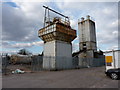
Remains of a concrete plant
The rusting and dilapidated remains of the old Hanson concrete plant in Newport. It originally (in the 1970s and 80s) belonged to Amey Roadstone Construction, more commonly known as ARC, the UK trading name of the business owned at that time by the South African mining firm Consolidated Gold Fields. After a brief period of ownership by Hanson, followed by an independent existence on the London Stock Exchange, the Amey Contracting and Services part of the business was acquired by a Spanish firm (Ferrovial), whilst the construction materials operation remains with Hanson which in turn was acquired by Heidelberg in 2007 (Are you keeping up?) This particular plant seems to have reached the end of its life.
Image: © Richard Law
Taken: 4 Apr 2013
0.04 miles
2

Baddeley Court and car park, Newport, Shrops
Baddeley Court was the result of the conversion of a former Budgens supermarket into smaller retail units. It was completed in 2019. Occupiers of the units include Specsavers, Peacocks and Cardfactory.
Image: © P L Chadwick
Taken: 3 Mar 2025
0.07 miles
3
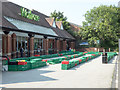
Coronavirus Entrance Chicane: Waitrose
During the coronavirus pandemic, customers are expected to keep 2 metres apart and supermarkets have adopted various means of managing the consequent queues. This is the solution adopted by Waitrose, Newport, Shropshire
Image: © Mike White
Taken: 24 Jun 2020
0.07 miles
4
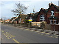
Newport C of E Junior School
The school is more or less next door to the Image
Image: © Richard Law
Taken: 4 Apr 2013
0.08 miles
6
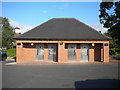
Public toilets, Stafford Street car park, Newport
Image: © Richard Vince
Taken: 19 Jun 2015
0.10 miles
7
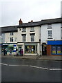
74 Upper Bar, Newport
Another early 19th century town house, converted more recently on the ground floor to retail use. It was Grade II listed https://britishlistedbuildings.co.uk/101054343-74-upper-bar-newport#.YONyZehKjIU & https://historicengland.org.uk/listing/the-list/list-entry/1054343 in 1978.
Image: © Richard Law
Taken: 9 Apr 2021
0.11 miles
8
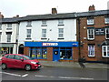
70 & 72 Upper Bar, Newport
The shop frontage is modern, but the substantial part of this building dates from the early 19th century. It was Grade II listed https://britishlistedbuildings.co.uk/101054342-70-and-72-upper-bar-newport#.YONxH-hKjIU & https://historicengland.org.uk/listing/the-list/list-entry/1054342 in 1978 for group value with surrounding properties.
Image: © Richard Law
Taken: 9 Apr 2021
0.11 miles
9
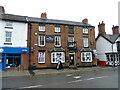
The Pheasant Inn, Newport
Built around the middle of the 19th century, and Grade II listed https://britishlistedbuildings.co.uk/101294933-pheasant-inn-newport#.YONv1uhKjIU & https://historicengland.org.uk/listing/the-list/list-entry/1294933 in 1978 for group value with surrounding properties.
Image: © Richard Law
Taken: 9 Apr 2021
0.11 miles
10
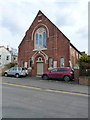
Newport C of E church
A foundation stone, at the foot of the buttress behind the red car, states that it was laid by E. Crapper, Esq on July 17th 1876.
Image: © Richard Law
Taken: 4 Apr 2013
0.11 miles