1
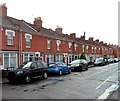
Southgate Avenue, Bridgwater
Viewed from the canal end looking towards Taunton Road.
Image: © Jaggery
Taken: 4 Oct 2012
0.02 miles
2
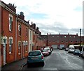
Old Taunton Road, Bridgwater
Looking south towards Southgate Avenue.
Image: © Jaggery
Taken: 4 Oct 2012
0.03 miles
3
Boundary post on the canal bank
Oddly enough this iron marker, embedded in the ground on the canal path, is unmistakably property of the Great Western Railway Company. Perhaps it is reused? See
Image] for a contextual view.
Image: © Neil Owen
Taken: 5 Sep 2013
0.04 miles
4
Railway marker on the canal
This iron boundary marker is property of the Great Western Railway Company and is dated 1895. Perhaps it is not of significance but the flats opposite are built on what was the former Hamp Brick and Tile Works. See
Image] for a closer look at the post.
Image: © Neil Owen
Taken: 5 Sep 2013
0.04 miles
5
Swans and cygnets on the canal, Bridgwater
The Bridgwater and Taunton Canal.
Image: © Jaggery
Taken: 4 Oct 2012
0.04 miles
6
Old Toll House, Taunton Road, Bridgwater
Old Toll House, No. 103, Taunton Road.
Grade II listed.
List Entry Number: 1298776 https://historicengland.org.uk/listing/the-list/list-entry/1298776
Surveyed
Milestone Society National ID: SO.BRW02
Image: © Alan Rosevear
Taken: 29 May 2005
0.04 miles
7
Apartment blocks by canal, Bridgwater
Image: © David Smith
Taken: 5 Aug 2020
0.04 miles
8
Canalside house construction, Bridgwater
Viewed from this http://www.geograph.org.uk/photo/4413054 bridge in October 2012, when houses are being built
alongside the Bridgwater and Taunton Canal east of Old Taunton Road.
Image: © Jaggery
Taken: 4 Oct 2012
0.05 miles
9
Canalside pylon with platform, Bridgwater
Viewed across the Bridgwater and Taunton Canal.
Image: © Jaggery
Taken: 4 Oct 2012
0.05 miles
10
Close to the power
An unusual electricity installation close to the new apartments of Riverside Walk. The electricity supply was here long before the flats, but used to be carried above ground towards the Taunton Road.
Image: © Neil Owen
Taken: 5 Sep 2013
0.05 miles


