IMAGES TAKEN NEAR TO
Hamp Ward, BRIDGWATER, TA6 6AL

Introduction

This page details the photographs taken nearby to Hamp Ward, TA6 6AL by members of the Geograph project.

The Geograph project started in 2005 with the aim of publishing, organising and preserving representative images for every square kilometre of Great Britain, Ireland and the Isle of Man.

There are currently over 7.5m images from over14,400 individuals and you can help contribute to the project by visiting https://www.geograph.org.uk

Image Map


Images are licensed for reuse under creativecommons.org/licenses/by-sa/2.0
Notes
  • Clicking on the map will re-center to the selected point.
  • The higher the marker number, the further away the image location is from the centre of the postcode.

Image Listing (128 Images Found)

Images are licensed for reuse under creativecommons.org/licenses/by-sa/2.0
  • ...
Image
Details
Distance
1
You'll need a licence
Browne's Pond is a very popular place for fisher folk. You can even get lessons if you want. See Image] for another view.
Image: © Neil Owen Taken: 5 Sep 2013
0.01 miles
2
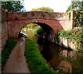
Canal bridge, Bridgwater
Image: © Roger Cornfoot Taken: 11 Jan 2014
0.02 miles
3
West side of canal bridge 5, Bridgwater
Carrying a lane over the Bridgwater & Taunton Canal near Browne's Pond. http://www.geograph.org.uk/photo/4480672
Image: © Jaggery Taken: 4 Oct 2012
0.02 miles
4
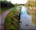
Mallard drake on the canal, Bridgwater
On the Bridgwater & Taunton Canal near this http://www.geograph.org.uk/photo/4480743 bridge. Mallard drakes (males) have a glossy green head, and are grey on the wings and belly, whereas female mallards have mainly brown-speckled plumage.
Image: © Jaggery Taken: 4 Oct 2012
0.02 miles
5
Bridgwater : Bridgwater and Taunton Canal
Looking towards a bridge over the Bridgwater and Taunton Canal.
Image: © Lewis Clarke Taken: 20 Feb 2016
0.02 miles
6
Bridge No 5, Bridgwater and Taunton Canal
Image: © Roger Cornfoot Taken: 12 Nov 2016
0.02 miles
7
Browne's Pond
Browne's Pond is a popular fishing area, as well as a wildlife refuge. See Image] for more views.
Image: © Neil Owen Taken: 5 Sep 2013
0.02 miles
8
Bridgwater : Bridgwater and Taunton Canal
The Bridgwater and Taunton Canal is a canal in the south-west of England between Bridgwater and Taunton, opened in 1827 and linking the River Tone to the River Parrett.
Image: © Lewis Clarke Taken: 20 Feb 2016
0.02 miles
9
Bridgwater : Bridgwater and Taunton Canal
Despite commercial traffic ceasing in 1907, the infrastructure was maintained in good order, and the canal was used for the transport of potable water from 1962. The Countryside Act 1968 provided a framework for Somerset County Council to start the restoration of the canal as a leisure facility, which was completed in 1994, when the canal was reopened throughout.
Image: © Lewis Clarke Taken: 20 Feb 2016
0.02 miles
10
East side of canal bridge 5, Bridgwater
Carrying a lane over the Bridgwater & Taunton Canal.
Image: © Jaggery Taken: 4 Oct 2012
0.02 miles
  • ...