
IMAGES TAKEN NEAR TO
Pesters Lane, SOMERTON, TA11 7AB
Introduction
This page details the photographs taken nearby to Pesters Lane, TA11 7AB by members of the Geograph project.
The Geograph project started in 2005 with the aim of publishing, organising and preserving representative images for every square kilometre of Great Britain, Ireland and the Isle of Man.

There are currently over 7.5m images from over14,400 individuals and you can help contribute to the project by visiting https://www.geograph.org.uk
Image Map
Images are licensed for reuse under creativecommons.org/licenses/by-sa/2.0
Notes
- Clicking on the map will re-center to the selected point.
- The higher the marker number, the further away the image location is from the centre of the postcode.
Image Listing (165 Images Found)
Images are licensed for reuse under creativecommons.org/licenses/by-sa/2.0
Image
Details
Distance
1
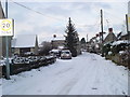
Pesters Lane
A photograph of Pesters Lane in the snow taken in January 2010
Image: © Michael Gay
Taken: 6 Jan 2010
0.01 miles
2
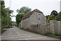
Cottage in Lower Somerton
This cottage which appears to have been converted from an earlier building is located right next to the Mill Stream.
Image: © Nigel Mykura
Taken: 17 May 2017
0.04 miles
3

Cottages, Lower Somerton
Lias stone cottages southeast of the town centre.
Image: © Derek Harper
Taken: 15 Oct 2008
0.09 miles
4
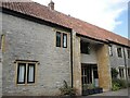
Somerton tithe barn
The barn dates from the fifteenth century and is associated with the nearby Parsonage Farm, but was sold in 1921 and is now converted into residential units. Grade II listed, despite the many significant changes in its history.
Image: © Neil Owen
Taken: 28 Jul 2022
0.11 miles
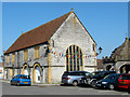
6
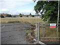
Kirkham Street playing field
The site is now abandoned and overgrown, but was originally a cricket ground; it then became the school fields before the construction of a new school elsewhere.
Image: © Neil Owen
Taken: 28 Jul 2022
0.13 miles
7
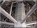
The roof structure, Market Cross, Somerton
Image: © Ken Grainger
Taken: 4 Jun 2010
0.13 miles
8
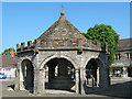
Market Cross, Somerton
An octagonal building dating from 1673
Image: © Ken Grainger
Taken: 4 Jun 2010
0.14 miles
9
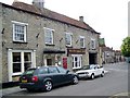
The White Hart, Somerton
Although the front of the building is late 18th century, it is believed that the building itself is much older. The inn was also know as the Bear Inn in earlier times. For a close-up of the sign Image
Image: © Maigheach-gheal
Taken: 20 May 2010
0.14 miles
10
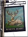
Sign for the White Hart
The white hart was the favourite badge of Richard II (June 1377-September 1399) and most pubs with this name are influenced by this. But the White Hart is not always shown as the heraldic animal. He is sometimes painted realistically. Frequently, the white hart has a golden collar or a gold chain around his neck. This stems from the legend, as reported by Aristotle, that Diomedes consecrated a white hart to Diana and placed a collar of gold around its neck. The same story has been told with different casts - Julius Caesar, Alexander the Great, Charlemagne and Henry the Lion.
Image: © Maigheach-gheal
Taken: 20 May 2010
0.14 miles