IMAGES TAKEN NEAR TO
Parys Road, LUDLOW, SY8 1XB
Introduction
This page details the photographs taken nearby to Parys Road, SY8 1XB by members of the Geograph project.
The Geograph project started in 2005 with the aim of publishing, organising and preserving representative images for every square kilometre of Great Britain, Ireland and the Isle of Man.

There are currently over 7.5m images from over14,400 individuals and you can help contribute to the project by visiting https://www.geograph.org.uk
Image Map (Loading...)


Getting Data...Please wait
Leaflet Map data © OpenStreetMap
Images are licensed for reuse under creativecommons.org/licenses/by-sa/2.0
Notes
- Clicking on the map will re-center to the selected point.
- The higher the marker number, the further away the image location is from the centre of the postcode.
Image Listing (67 Images Found)
Images are licensed for reuse under creativecommons.org/licenses/by-sa/2.0
Image
Details
Distance
1
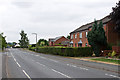
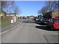
Parys Road
Part of a late 1980s development of this part of Ludlow, although the bungalow in the centre is earlier, being one of a pair shown on the 1968-9 1:2500 map (the second one has been replaced by the building beyond), and the route of this section of the road is much older, having originally been part easternmost end of Dark Lane (see Image for where Dark Lane now ends on Parys Road).
Image: © Ian Capper
Taken: 21 Jul 2013
0.01 miles
2

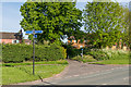
Guy Thornycroft Court
Retirement/sheltered housing on Toll Gate Road, built in 1987.
Image: © Ian Capper
Taken: 19 May 2016
0.03 miles
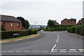
3
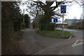
Toll Gate Road
Cul de sac off Parys Road, part of a late 1980s development of this part of Ludlow.
Image: © Ian Capper
Taken: 19 May 2016
0.03 miles
4
Toll Gate Road
Cul de sac off Parys Road, part of a late 1980s development of this part of Ludlow.
Image: © Ian Capper
Taken: 21 Jul 2013
0.04 miles
5

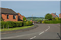
Sheet Road
1970s houses on what was historically the lane connecting Ludlow with Sheet and Caynham. In the background is the tower of St Laurence's Church.
Image: © Ian Capper
Taken: 21 Jul 2013
0.06 miles
6
Orleton Road
Cul de sac in Ludlow Business Park, off Parys Road.
Image: © Ian Capper
Taken: 19 May 2016
0.06 miles
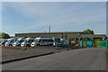
7
Ludlow Business Park
Orleton Road on Ludlow Business Park.
Image: © Michael Patterson
Taken: 5 Apr 2006
0.07 miles
8
Dark Lane
Old footpath now serving as a link between Parys Road, Gallows Bank and Rock Lane. This photo shows its start off Parys Road.
Image: © Ian Capper
Taken: 19 May 2016
0.07 miles
10

Ash Close
Cul de sac off Toll Gate Road, part of a late 1980s development of this part of Ludlow.
Image: © Ian Capper
Taken: 19 May 2016
0.09 miles