IMAGES TAKEN NEAR TO
Sheppards Barns, WELSHPOOL, SY21 9JH
Introduction
This page details the photographs taken nearby to Sheppards Barns, SY21 9JH by members of the Geograph project.
The Geograph project started in 2005 with the aim of publishing, organising and preserving representative images for every square kilometre of Great Britain, Ireland and the Isle of Man.

There are currently over 7.5m images from over14,400 individuals and you can help contribute to the project by visiting https://www.geograph.org.uk
Image Map
Images are licensed for reuse under creativecommons.org/licenses/by-sa/2.0
Notes
- Clicking on the map will re-center to the selected point.
- The higher the marker number, the further away the image location is from the centre of the postcode.
Image Listing (21 Images Found)
Images are licensed for reuse under creativecommons.org/licenses/by-sa/2.0
Image
Details
Distance
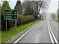
2
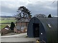
The Moors
Farm buildings redeveloped as residential accommodation on the A483 just north of Welshpool. The main road here has been raised by a foot or so in recent years to avoid flooding problems from the nearby River Severn.
Image: © Penny Mayes
Taken: 15 Sep 2009
0.01 miles
3
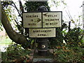
Montgomery Canal 20 mile milepost
This replica milepost is installed on the left bank as you travel to Newtown and the boater would see how far he has to travel to Newtown first. This does create confusion in some people's minds hence the scrawled arrows on this sign. The inscription reads "This milepost was placed here by The Montgomery Waterway Restoration Trust on 25th September 1983 and is dedicated to the memory of Kenneth Douglas Allnutt 1939 - 1982 who spent some of his happiest hours on the waterways of Britain. Donated by family, friends & colleagues".
Image: © John Haynes
Taken: 10 Oct 2007
0.02 miles
6
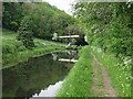
Lift bridge at The Moors, by Welshpool, on the Montgomery Canal
The Shropshire Union Canal has several of this type of counter balance lift bridge. To raise the bridge you pull on the rope or chain.
Image: © John Haynes
Taken: 15 May 2004
0.03 miles
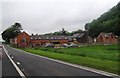
7
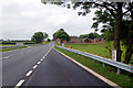
Entrance to farm by A483
Sign for "The Moors" a farm and Bed and Breakfast
Image: © David Smith
Taken: 5 May 2023
0.06 miles
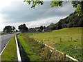
8
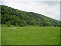
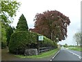
On Offa's Dyke Path north of Buttington
Following the National Trail north of Buttington, beside the River Severn. This looks roughly north to woods on the other side of the A483 and Montgomery Canal.
Image: © Chris Heaton
Taken: 21 May 2008
0.09 miles
9
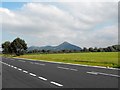
View of Moel y Golfa and Breidden
The highest hill in this view is Moel y Golfa (403m) in Image Viewed from a layby on the A483 Oswestry road just north of Buttington Cross.
Image: © Penny Mayes
Taken: 15 Sep 2009
0.10 miles