1
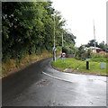
Plantation Lane by Newtown High School
Image: © Colin Pyle
Taken: 6 Jan 2011
0.07 miles
2
Garthowen Shops, Plantation Lane, Newtown, Powys
The shops at Garthowen, Newtown, Powys
Image: © Henry Spooner
Taken: 27 May 2009
0.07 miles
3
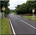
Start of the 30 zone and pavements in Newtown
Viewed along the A483 Dolfor Road. Upper Dolfor Road joins from the right.
The end of the grass verge and the start of pavements at the southern edge of Newtown
coincides with the reduction in the speed limit from the National Speed Limit to 30mph.
Image: © Jaggery
Taken: 4 Aug 2013
0.10 miles
4
Canolfan Hamdden Maldwyn
Waiting in line for my booster vaccination at Newtown Leisure Centre, I found myself really appreciating the original signage of this typical early 1980s civic facility. Maldwyn - the old Welsh name for Montgomeryshire - was abolished as a county council in 1974, and a constituent district council of Powys in 1996. The name lives on!
Under a brilliant blue mid-winter sky, I felt so lucky to be having my jab, and lucky too to have known a time when councils had the budgets and ambition to invest in their people.
Image: © Mike Parker
Taken: 19 Dec 2021
0.12 miles
5
Southern boundary of Newtown, Powys
The A483 Dolfor Road passes the boundary sign at the southern edge of Newtown, the largest town in Powys. Its population was 12,783 on the day of the 2001 Census.
The sign states that Newtown has been a new town since 1279. It is twinned with Les Herbiers (France).
Image: © Jaggery
Taken: 4 Aug 2013
0.12 miles
6
Entering Newtown
Welcome sign on Dolfor Road (A483) on the southern outskirts of Newtown.
Image: © David Dixon
Taken: 15 Apr 2016
0.12 miles
7
Upper Dolfor Road, Newtown
At the southern edge of Newtown, Upper Dolfor Road diverges from the A483 Dolfor Road. The circular sign with a red edge shows that vehicles weighing more than 7.5 tonnes are prohibited, except for access.
Image: © Jaggery
Taken: 4 Aug 2013
0.13 miles
8
Heol Ashley extension, Mochdre Estate
Heading for the new roundabout on A483 Dolfor Road.
The houses up on the right are on Upper Dolfor Road.
Image: © Penny Mayes
Taken: 6 Jan 2019
0.13 miles
9
Riding up Dolfor Road
Approaching the intersection with the feeder roads on/off the new Newtown bypass, at the start of a hot afternoon on the hills to the south of the town.
Image: © Richard Law
Taken: 9 Jul 2022
0.13 miles
10
Newtown High School, Plantation Lane, Newtown, Powys
The main block of Newtown High School, Plantation Lane, Newtown, Powys.
Image: © Henry Spooner
Taken: 27 May 2009
0.14 miles


