IMAGES TAKEN NEAR TO
Selattyn, OSWESTRY, SY10 7NP
Introduction
This page details the photographs taken nearby to SY10 7NP by members of the Geograph project.
The Geograph project started in 2005 with the aim of publishing, organising and preserving representative images for every square kilometre of Great Britain, Ireland and the Isle of Man.

There are currently over 7.5m images from over14,400 individuals and you can help contribute to the project by visiting https://www.geograph.org.uk
Image Map
Images are licensed for reuse under creativecommons.org/licenses/by-sa/2.0
Notes
- Clicking on the map will re-center to the selected point.
- The higher the marker number, the further away the image location is from the centre of the postcode.
Image Listing (17 Images Found)
Images are licensed for reuse under creativecommons.org/licenses/by-sa/2.0
Image
Details
Distance
1
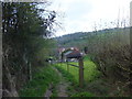
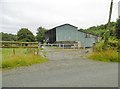
Offa's Dyke Path descends towards Craignant
The path squeezes by this cottage and outbuildings.
Image: © John Haynes
Taken: 7 May 2013
0.00 miles
2
At Craignant
A scene from Offa's Dyke Path at Craignant.
Wikipedia https://en.wikipedia.org/wiki/Offa%27s_Dyke_Path
Image: © Jeff Buck
Taken: 14 Oct 2022
0.06 miles
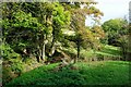
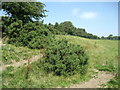
3
Climbing up from Craignant
The Offa's Dyke path climbs through bracken on the north side of the valley of Morlas Brook
Image: © Tim Heaton
Taken: 27 Jul 2008
0.08 miles
4
Offa's Dyke Path
The path follows an access track up the slope out of Craignant.
Image: © John Haynes
Taken: 7 May 2013
0.13 miles
5
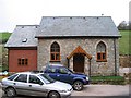
Converted chapel at Craignant
The chapel was originally built in 1866 as English Methodist (it's just on the English side of the Welsh border). The current owner was christened here and when it later came up for sale (complete with all the fittings including the font), he jumped at the chance and renovated it three and a half years ago. He told me that on the day of the last service, an unfortunate lady injured her leg when it went through the floorboard.
Image: © Peter Craine
Taken: 31 Jan 2007
0.14 miles
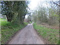
6
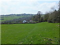
Descending towards Craignant
The hamlet of Craignant is hidden in a valley and the Offa's Dyke Path drops down steeply.
Image: © John Haynes
Taken: 7 May 2013
0.15 miles
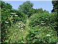
7
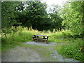
Picnic Site in Craignant
Picnic Site in a disused quarry in Craignant, not far from the Offa's Dyke National Trail.
Image: © Chris Heaton
Taken: 26 Jul 2008
0.16 miles
8
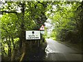
Selattyn, welcome sign
Leaving Wales and entering Shropshire, on B4579.
Image: © Mike Faherty
Taken: 2 Aug 2017
0.16 miles
10
Offa's Dyke north of Craignant
The dyke actually forms the national boundary between England and Wales at this point, with the national trail also following the ancient earthworks.
Image: © Chris Heaton
Taken: 27 Jul 2008
0.17 miles