Converted chapel at Craignant
Introduction
The photograph on this page of Converted chapel at Craignant by Peter Craine as part of the Geograph project.
The Geograph project started in 2005 with the aim of publishing, organising and preserving representative images for every square kilometre of Great Britain, Ireland and the Isle of Man.

There are currently over 7.5m images from over 14,400 individuals and you can help contribute to the project by visiting https://www.geograph.org.uk
Converted chapel at Craignant
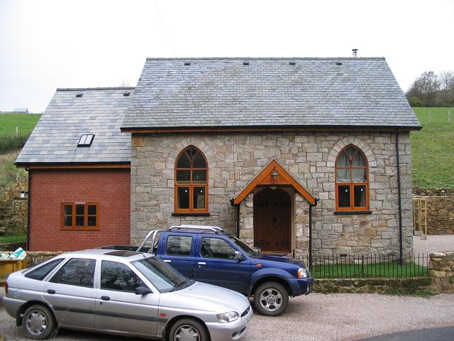
Image: © Peter Craine Taken: 31 Jan 2007
The chapel was originally built in 1866 as English Methodist (it's just on the English side of the Welsh border). The current owner was christened here and when it later came up for sale (complete with all the fittings including the font), he jumped at the chance and renovated it three and a half years ago. He told me that on the day of the last service, an unfortunate lady injured her leg when it went through the floorboard.
Images are licensed for reuse under creativecommons.org/licenses/by-sa/2.0
Image Location


Leaflet Map data © OpenStreetMap
Latitude
52.90726
Longitude
-3.107684