
IMAGES TAKEN NEAR TO
St. Alphonsus Road, LONDON, SW4 7BN
Introduction
This page details the photographs taken nearby to St. Alphonsus Road, SW4 7BN by members of the Geograph project.
The Geograph project started in 2005 with the aim of publishing, organising and preserving representative images for every square kilometre of Great Britain, Ireland and the Isle of Man.

There are currently over 7.5m images from over14,400 individuals and you can help contribute to the project by visiting https://www.geograph.org.uk
Image Map
Images are licensed for reuse under creativecommons.org/licenses/by-sa/2.0
Notes
- Clicking on the map will re-center to the selected point.
- The higher the marker number, the further away the image location is from the centre of the postcode.
Image Listing (187 Images Found)
Images are licensed for reuse under creativecommons.org/licenses/by-sa/2.0
Image
Details
Distance
1
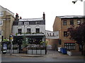
The King's Head Public House, Clapham
On Clapham Park Road.
Image: © David Anstiss
Taken: 3 Jun 2012
0.07 miles
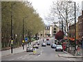
3
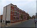
Park Court, Abbeville Road, Clapham
A block of twentieth century flats; the southern end of Abbeville Road was developed before this northern end, despite this latter being closer to the centre of London
Image: © David Smith
Taken: 28 Nov 2013
0.08 miles
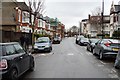
8
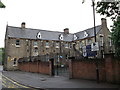
St Mary's Roman Catholic Primary School, Clapham
Large primary school Crescent Road.
Image: © David Anstiss
Taken: 3 Jun 2012
0.11 miles
10
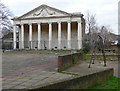
Former orangery, Worsopp Drive
With an elegant Ionic portico and pediment adorned with cartouche and festoons. Built in 1793 to the designs of Dr William Burgh of York. It was originally attached to Thornton House, demolished in the 1940s, and now stands desultorily in the middle of a post-war housing estate. It is on English Heritage's Heritage at Risk Register. Grade II listed.
Image: © Stephen Richards
Taken: 6 Mar 2011
0.12 miles