
IMAGES TAKEN NEAR TO
Jeffreys Walk, LONDON, SW4 6QQ
Introduction
This page details the photographs taken nearby to Jeffreys Walk, SW4 6QQ by members of the Geograph project.
The Geograph project started in 2005 with the aim of publishing, organising and preserving representative images for every square kilometre of Great Britain, Ireland and the Isle of Man.

There are currently over 7.5m images from over14,400 individuals and you can help contribute to the project by visiting https://www.geograph.org.uk
Image Map
Images are licensed for reuse under creativecommons.org/licenses/by-sa/2.0
Notes
- Clicking on the map will re-center to the selected point.
- The higher the marker number, the further away the image location is from the centre of the postcode.
Image Listing (171 Images Found)
Images are licensed for reuse under creativecommons.org/licenses/by-sa/2.0
Image
Details
Distance
1
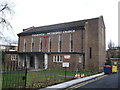
Stockwell Methodist Church
On Jeffrey's Road.
Image: © David Anstiss
Taken: 30 Dec 2012
0.04 miles
2
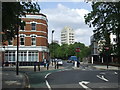
Larkhall Lane, SW4
Larkhall Lane, near Stockwell in South London.
"No entry" signs prevent motor vehicles from going straight ahead, to deter "rat running" traffic from these residential roads. There are however two routes for cyclists, to go straight ahead or to the left. All other vehicles have no option but to turn right here.
Image: © Malc McDonald
Taken: 30 May 2011
0.06 miles
3
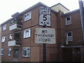
Pair of pre-Worboys signs, Levehurst Way, Stockwell
Until recently at least three Lambeth Council estates still had their pre-Worboys signs in place, luckily I discovered them all before they started removing them around 2010.
Image: © David Howard
Taken: 6 Jul 2009
0.08 miles
4
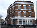
The Former Larkhall Tavern
On the corner of Larkhall Lane and Priory Grove.
Before it was converted into flats, the pub was used in the film 'Last Orders'.
Bob Hoskins, Ray Winstone, Tom Courtenay and David Hemmings meet there before setting off to scatter Michael Caine's ashes.
See http://en.wikipedia.org/wiki/Last_Orders for more details on the film.
Image: © David Anstiss
Taken: 30 Dec 2012
0.08 miles
5
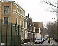
Priory Grove, SW8
These houses, forming a terrace of varied character, face Larkhall Park - see http://www.geograph.org.uk/gridref/TQ2976?class=Park .
Image: © Derek Harper
Taken: 2 Feb 2011
0.11 miles
7
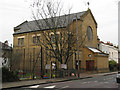
St Francis de Sales church, Larkhall Lane
A Roman Catholic church in South Lambeth. From information on the parish website [no longer available] it appears to have been built in 1902. The proportions of the building look awkward and suggest that it was designed to be longer than the present three bays.
The parish appears to specialise in ministry to the Spanish and Portuguese speaking communities.
Image: © Stephen Craven
Taken: 4 Feb 2010
0.13 miles
9
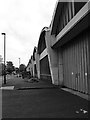
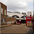
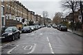
Stockwell Bus Garage
Grade II* listed bus garage built in the early 1950s to the designs of architects Adie Button & Partners. More at this https://www.architecture.com/Explore/Buildings/StockwellBusGarage.aspx. Architectural description at this https://www.historicengland.org.uk/listing/the-list/list-entry/1249757.
Image: © Jim Osley
Taken: 23 Oct 2016
0.15 miles
10
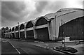
Stockwell Bus Garage
Hailed by the 20th Century Society as " one of the finest examples of post war modernist architecture". Grade II* listed - see this https://www.historicengland.org.uk/listing/the-list/list-entry/1249757.
Image: © Jim Osley
Taken: 23 Oct 2016
0.15 miles