
IMAGES TAKEN NEAR TO
Streatham Hill, LONDON, SW2 4RU
Introduction
This page details the photographs taken nearby to Streatham Hill, SW2 4RU by members of the Geograph project.
The Geograph project started in 2005 with the aim of publishing, organising and preserving representative images for every square kilometre of Great Britain, Ireland and the Isle of Man.

There are currently over 7.5m images from over14,400 individuals and you can help contribute to the project by visiting https://www.geograph.org.uk
Image Map
Images are licensed for reuse under creativecommons.org/licenses/by-sa/2.0
Notes
- Clicking on the map will re-center to the selected point.
- The higher the marker number, the further away the image location is from the centre of the postcode.
Image Listing (129 Images Found)
Images are licensed for reuse under creativecommons.org/licenses/by-sa/2.0
Image
Details
Distance
3
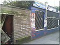
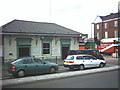
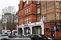
Derelict shop in Sternhold Avenue
It is clearly a good few years since these insurance consultants, next to Streatham Hill station, were giving out advice.
By 2016 the sad remains had been demolished.
Image: © Marathon
Taken: 24 Feb 2011
0.02 miles
5
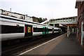
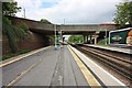
Streatham Hill Station, Streatham High Road.
Image: © Noel Foster
Taken: 11 Jul 2005
0.02 miles
7
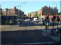
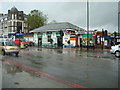
A23, Streatham Hill
The single story building on the left is Streatham Hill Station
Image: © Oxyman
Taken: 29 May 2009
0.02 miles
8
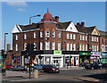
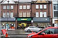
172-178 Streatham Hill
On a prominent position opposite the start of Leigham Court Road. The roofline helps with its semi-hexagonal corner bay topped by a dome with a spire, "ironically not dissimilar to a First World War German soldier's helmet." Ironic because this polite group of shops with flats above was built on the site of Arborfield, a large house destroyed during a Zeppelin raid on 24th September 1916. It is within the Streatham High Road and Streatham Hill Conservation Area.
The course of Streatham High Road has been a major highway between London and Sussex since Roman times. Its current appearance is largely attributable to two major spells of development. The first was during the late C19th following the opening of Streatham Hill station in 1856, and the second was after 1911 when the line to Victoria was electrified. Though much-maligned and undoubtedly blighted by heavy traffic, closer examination reveals that the road is lined with a number of interesting buildings, some of which reflect the period between the wars when Streatham was a fashionable centre of entertainment. Information from Lambeth Council (http://www.lambeth.gov.uk/NR/exeres/CE4B5CE1-0387-40ED-B5A9-273A5160C34A.htm ).
Image: © Stephen Richards
Taken: Unknown
0.03 miles
10
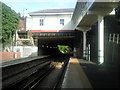
Streatham Hill station looking towards Leigham Tunnel
Streatham Hill station was called Streatham station when it opened in 1856. The original station buildings of that time survive above the bridge, although the original staircases to the platforms were replaced in 2009 with the bridge on the right of this photograph. Leigham Tunnel is in the distance on the way to West Norwood.
Image: © Marathon
Taken: 1 Sep 2010
0.03 miles