Streatham Hill station looking towards Leigham Tunnel
Introduction
The photograph on this page of Streatham Hill station looking towards Leigham Tunnel by Marathon as part of the Geograph project.
The Geograph project started in 2005 with the aim of publishing, organising and preserving representative images for every square kilometre of Great Britain, Ireland and the Isle of Man.

There are currently over 7.5m images from over 14,400 individuals and you can help contribute to the project by visiting https://www.geograph.org.uk
Streatham Hill station looking towards Leigham Tunnel
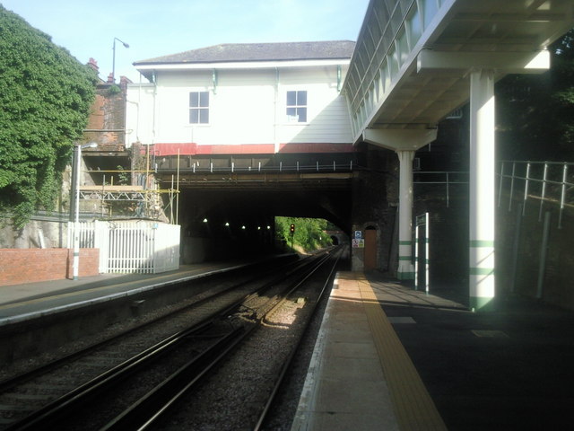
Image: © Marathon Taken: 1 Sep 2010
Streatham Hill station was called Streatham station when it opened in 1856. The original station buildings of that time survive above the bridge, although the original staircases to the platforms were replaced in 2009 with the bridge on the right of this photograph. Leigham Tunnel is in the distance on the way to West Norwood.
Images are licensed for reuse under creativecommons.org/licenses/by-sa/2.0
Image Location
Latitude
51.438317
Longitude
-0.126579