
IMAGES TAKEN NEAR TO
Copse Hill, LONDON, SW20 0SU
Introduction
This page details the photographs taken nearby to Copse Hill, SW20 0SU by members of the Geograph project.
The Geograph project started in 2005 with the aim of publishing, organising and preserving representative images for every square kilometre of Great Britain, Ireland and the Isle of Man.

There are currently over 7.5m images from over14,400 individuals and you can help contribute to the project by visiting https://www.geograph.org.uk
Image Map
Images are licensed for reuse under creativecommons.org/licenses/by-sa/2.0
Notes
- Clicking on the map will re-center to the selected point.
- The higher the marker number, the further away the image location is from the centre of the postcode.
Image Listing (57 Images Found)
Images are licensed for reuse under creativecommons.org/licenses/by-sa/2.0
Image
Details
Distance
2
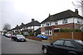
Houses in Burdett Avenue
The houses in this area tend to be large with significant extensions but with quite small gardens. Often the houses have been extended to such an extent that they cover nearly as much land as the garden. Prices in this area (January 2016) currently quoted on the market vary from £750,000 for a four bed semi to £2.25M for a seven bed detached.
Image: © Nigel Mykura
Taken: 3 Dec 2015
0.04 miles
3
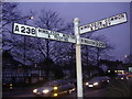
An old signpost
Coombe Lane is still the A238.
Image: © Bill Boaden
Taken: 14 Aug 2010
0.05 miles
5
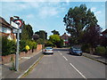
Burdett Avenue, near Raynes Park
Burdett Avenue is a residential road in the outer suburbs of south west London.
Image: © Malc McDonald
Taken: 1 Jul 2018
0.06 miles
9
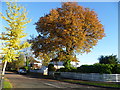
Cottenham Park Road in autumn
Cottenham Park Road leads off Coombe Lane. A horse trough is on the other side if the road, just visible in the shade.
Image: © Marathon
Taken: 14 Nov 2012
0.08 miles
10
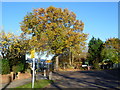
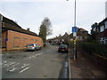
St Matthew's Church of England Primary School and Cottenham Park Road
Cottenham Park Road leads off Coombe Lane. A short way along it becomes a footpath alongside St Matthew's Church of England Primary School. The footpath is seen here on the right while the school entrance is on the left.
Image: © Marathon
Taken: 14 Nov 2012
0.08 miles