IMAGES TAKEN NEAR TO
Cambridge Road, LONDON, SW20 0SN
Introduction
This page details the photographs taken nearby to Cambridge Road, SW20 0SN by members of the Geograph project.
The Geograph project started in 2005 with the aim of publishing, organising and preserving representative images for every square kilometre of Great Britain, Ireland and the Isle of Man.

There are currently over 7.5m images from over14,400 individuals and you can help contribute to the project by visiting https://www.geograph.org.uk
Image Map
Images are licensed for reuse under creativecommons.org/licenses/by-sa/2.0
Notes
- Clicking on the map will re-center to the selected point.
- The higher the marker number, the further away the image location is from the centre of the postcode.
Image Listing (61 Images Found)
Images are licensed for reuse under creativecommons.org/licenses/by-sa/2.0
Image
Details
Distance
1
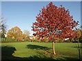
Acer, Holland Garden
A beautiful red maple on the western side of the main grass area of the garden. The oak shown in Image is on the left.
Image: © Derek Harper
Taken: 16 Nov 2010
0.06 miles
2
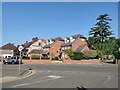
Lambton Road junction with Cambridge Road
Image: © James Emmans
Taken: 9 May 2020
0.08 miles
3
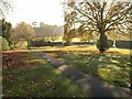
Holland Garden
Just the northeast corner of this park, to the far side of the fine oak tree, is in this square. "On July 19th 1928, Lady Holland passed the field to the Council to be used as a public recreation ground" http://www.friendsofhollandgarden.org.uk/garden.html .
Image: © Derek Harper
Taken: 16 Nov 2010
0.08 miles
4
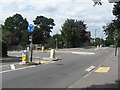
Roundabout, West Wimbledon
Junction of Cottenham Park Road with Pepys Road.
Image: © Richard Rogerson
Taken: 30 Jul 2010
0.12 miles
5
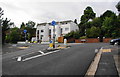
Mini-roundabout on Cottenham Park Road
This is viewed from Pepys Road. Cottenham Park Road runs across the top.
Image: © Bill Boaden
Taken: 14 Aug 2010
0.12 miles
6
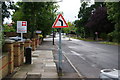
Bend ahead on the B281
Whilst Cottenham Park Road continues straight ahead, the B281 takes a left turn into Durham Road.
Image: © Bill Boaden
Taken: 14 Aug 2010
0.14 miles
7
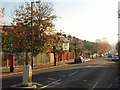
Durham Road, Cottenham Park
Seen from close to the T-junction with Cottenham Park Road. This is the B281.
Image: © Derek Harper
Taken: 16 Nov 2010
0.15 miles
8
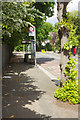
Durham Road, Raynes Park
This is near the top of Durham Road, near the junction with Cottenham Park Road. The bus stop is served by the no 200 to Mitcham.
Image: © Stephen McKay
Taken: 10 May 2018
0.15 miles
9
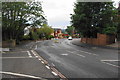
Cottenham Park Road
Hampton Close is the road off to the left. If there were no houses in the way, there would be a view for some miles to the south.
Image: © Bill Boaden
Taken: 14 Aug 2010
0.16 miles