IMAGES TAKEN NEAR TO
Urmston Drive, LONDON, SW19 6SF
Introduction
This page details the photographs taken nearby to Urmston Drive, SW19 6SF by members of the Geograph project.
The Geograph project started in 2005 with the aim of publishing, organising and preserving representative images for every square kilometre of Great Britain, Ireland and the Isle of Man.

There are currently over 7.5m images from over14,400 individuals and you can help contribute to the project by visiting https://www.geograph.org.uk
Image Map
Images are licensed for reuse under creativecommons.org/licenses/by-sa/2.0
Notes
- Clicking on the map will re-center to the selected point.
- The higher the marker number, the further away the image location is from the centre of the postcode.
Image Listing (13 Images Found)
Images are licensed for reuse under creativecommons.org/licenses/by-sa/2.0
Image
Details
Distance
2
Princes Way at the junction of Augustus Road
Image: © David Howard
Taken: 4 Aug 2014
0.07 miles
3
Linden Lodge School, Wimbledon
A special sensory and physical college.
See http://en.wikipedia.org/wiki/Linden_Lodge_School for slightly more details, inc; former blind pupils.
Image: © David Anstiss
Taken: 30 Dec 2012
0.11 miles
4
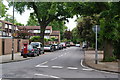
Augustus Road, Southfields
The traffic is very quiet but this is a Saturday.
Image: © Bill Boaden
Taken: 7 May 2011
0.12 miles
5
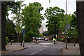
Cyclists on Augustus Road
They are crossing Victoria Drive by a mini-roundabout.
Image: © Bill Boaden
Taken: 7 May 2011
0.15 miles
6
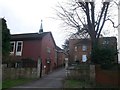
Struan House, Southfields
The Religious of Mary Immaculate Church and lodging building.
The church is used by a Roman Catholic community of women.
Image: © David Anstiss
Taken: 30 Dec 2012
0.16 miles
7
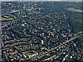
Wimbledon from the air
Wimbledon Common is on the right, Wimbledon Park is on the left, the tennis club can be seen in the distance.
Image: © Thomas Nugent
Taken: 19 Jun 2015
0.20 miles
8
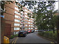
Block of flats on Ambleside, Southfields
Image: © David Howard
Taken: 4 Aug 2014
0.21 miles
9
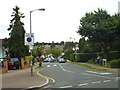
Girdwood Road, near Southfields
Girdwood Road is a residential road in south west London.
Image: © Malc McDonald
Taken: 9 Jul 2016
0.21 miles