1
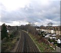
Railway to Hayden's Road
As seen from
Image
The houses on the right are along Kenlor Road.
Image: © David Anstiss
Taken: 9 Dec 2012
0.12 miles
2
South Wimbledon, railway bridge
Taking the Sutton to Blackfriars line over Wandle Meadow Nature Park.
Image: © Mike Faherty
Taken: 23 Nov 2013
0.12 miles
3
Colliers Wood - Overground Railway Line
Wimbledon to Tooting line Thameslink.
Thameslink mainline wikipedia : https://en.wikipedia.org/wiki/Thameslink
Image: © James Emmans
Taken: 28 Aug 2016
0.12 miles
4
Ingleby House, Blackshaw Road
Part of St George's Hospital. It "provides long term accommodation rentals and supports the St George's Hospital staff and patient visitors with accommodation."
Image: © Stephen Richards
Taken: 5 Sep 2012
0.13 miles
5
Railway bridge, Wandle Trail
Image: © N Chadwick
Taken: 17 May 2021
0.13 miles
6
Railway underpass near Haydons Road
The path is part of both the Wandle Trail and NCN 20 at this point. The railway above is part of the Thameslink Wimbledon loop line.
Image: © Stephen Craven
Taken: 29 Aug 2011
0.13 miles
7
Railway bridge, Wandle valley
The Wandle Trail, follows the Mead Path beneath the railway between Haydons Road and Tooting. The path, followed by NCN22, emerges beside the River Graveney.
Image: © Derek Harper
Taken: 30 Nov 2009
0.13 miles
8
Briscoe Road / Boundary Road junction
Two suburban roads cross in Collier's Wood. Briscoe Road is in the foreground. Ahead, Kimble Road, clearly of later date, is a no through road.
Image: © Derek Harper
Taken: 30 Nov 2009
0.13 miles
9
Footbridge on Boundary Road
This bridge leads to Kenlor Road, with a path to Blackshaw Road (and St George's Hospital).
It passes over the railway line between Tooting and Hayden's Road.
Image: © David Anstiss
Taken: 9 Dec 2012
0.14 miles
10
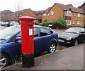
Pillar box, North Road
Edward VII postbox no SW19 108, where the NCN 22 and the Wandle Trail cross North Road.
Image: © Derek Harper
Taken: 30 Nov 2009
0.14 miles


