
IMAGES TAKEN NEAR TO
Eastfields Avenue, LONDON, SW18 1JU
Introduction
This page details the photographs taken nearby to Eastfields Avenue, SW18 1JU by members of the Geograph project.
The Geograph project started in 2005 with the aim of publishing, organising and preserving representative images for every square kilometre of Great Britain, Ireland and the Isle of Man.

There are currently over 7.5m images from over14,400 individuals and you can help contribute to the project by visiting https://www.geograph.org.uk
Image Map
Images are licensed for reuse under creativecommons.org/licenses/by-sa/2.0
Notes
- Clicking on the map will re-center to the selected point.
- The higher the marker number, the further away the image location is from the centre of the postcode.
Image Listing (227 Images Found)
Images are licensed for reuse under creativecommons.org/licenses/by-sa/2.0
Image
Details
Distance
1
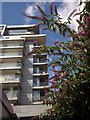
Buddleia, Riverside Quarter
At the northwestern end of the footpath from which Image was taken. The block is Mandel House, currently the easternmost riverside block in the Quarter.
Image: © Derek Harper
Taken: 3 Aug 2012
0.01 miles
2
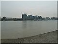
Putney Bridge to Parsons Green and back via Hurlingham (169)
The Thames as seen from Carnwath Path (2)
Image: © Basher Eyre
Taken: 26 Mar 2011
0.02 miles
3
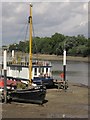
Moorings at Riverside Quarter
Boats moored at pontoons on the Thames beside the flats shown in Image The trees across the river are alongside Hurlingham Park.
Image: © Derek Harper
Taken: 3 Aug 2012
0.04 miles
4
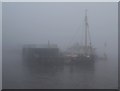
Fog at Riverside Quarter
Ghostly houseboats at a pontoon near Wandsworth, as thick fog envelopes the river.
Image: © Derek Harper
Taken: 16 Nov 2010
0.04 miles
5
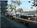
Riverside apartments overlooking the Thames
Backing onto Eastfield Avenue.
Image: © Russel Wills
Taken: 19 Nov 2011
0.05 miles
6

Grass, flowers and bushes by Bell Lane Creek
A footpath usable during daylight hours and skirting a long-standing development site on the east side of Riverside Quarter, now offers this view across the Thames at the mouth of the Wandle. Across the main river are the Piper Building (see Image) and Barton House (Image).
Image: © Derek Harper
Taken: 3 Aug 2012
0.06 miles
7
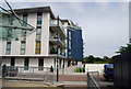
Thames Path goes through Riverside Quarter
Riverside Quarter is a riverside development of apartments.
Image: © N Chadwick
Taken: 25 Aug 2010
0.06 miles
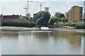
9
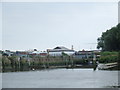
Mouth of the River Wandle
The River Wandle flows for around 9 miles from a source near Croydon through South London to flow into the River Thames here near Wandsworth.
Image: © Malc McDonald
Taken: 2 Jul 2011
0.06 miles
10
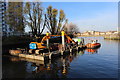
View from the Spit in Wandle creek near the confluence with the Thames
Image: © Roger Davies
Taken: 11 Dec 2016
0.06 miles